Approximate Location Map
Large Map »
Latitude: 50.7218 / 50°43'18"N
Longitude: -3.5301 / 3°31'48"W
OS Eastings: 292090
OS Northings: 92466
OS Grid: SX920924
Mapcode National: GBR P1.904N
Mapcode Global: FRA 37H5.GLD
Plus Code: 9C2RPFC9+PX
Entry Name: Wall of the Chantry
Listing Date: 18 June 1974
Grade: II
Source: Historic England
Source ID: 1267542
English Heritage Legacy ID: 418405
ID on this website: 101267542
Location: Exeter, Devon, EX1
County: Devon
District: Exeter
Electoral Ward/Division: St David's
Parish: Non Civil Parish
Built-Up Area: Exeter
Traditional County: Devon
Lieutenancy Area (Ceremonial County): Devon
Church of England Parish: Exeter Cathedral
Church of England Diocese: Exeter
Tagged with: Wall
PALACE GATE
1.
1092
(West Side)
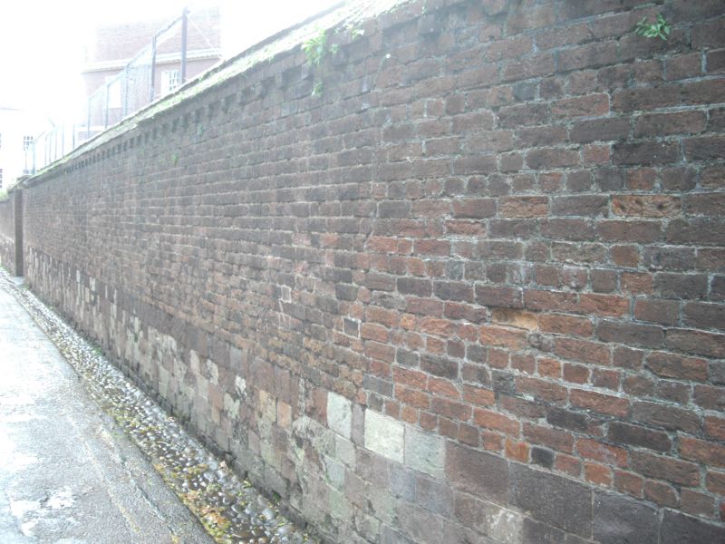
Wall of The Chantry
SX 9292 SW 6/1100A
II GV
2.
C18/C19. Heavitree stone rubble with the upper courses C19 red brick.
All the listed buildings in Palace Gate form a group.
Listing NGR: SX9208892468
External links are from the relevant listing authority and, where applicable, Wikidata. Wikidata IDs may be related buildings as well as this specific building. If you want to add or update a link, you will need to do so by editing the Wikidata entry.


Other nearby listed buildings
