Approximate Location Map
Large Map »
Latitude: 51.442 / 51°26'31"N
Longitude: 0.7499 / 0°44'59"E
OS Eastings: 591206
OS Northings: 175036
OS Grid: TQ912750
Mapcode National: GBR RS1.JDW
Mapcode Global: VHKJ6.Y09V
Plus Code: 9F32CPRX+RX
Entry Name: 53, High Street
Listing Date: 30 June 1978
Grade: II
Source: Historic England
Source ID: 1273519
English Heritage Legacy ID: 444606
ID on this website: 101273519
Location: Blue Town, Swale, Kent, ME12
County: Kent
District: Swale
Electoral Ward/Division: Sheerness
Parish: Sheerness
Built-Up Area: Sheerness
Traditional County: Kent
Lieutenancy Area (Ceremonial County): Kent
Tagged with: Building
1.
5282
TQ 9175 SW
2/20
HIGH STREET
(South Side)
Blue Town, Sheerness
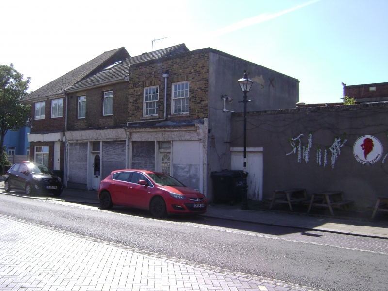
No 53
II
2.
Early C19. 3 storeys buff brick. Concealed roof and recessed panelled parapet.
2 sashes to each floor with glazing bars intact to 1st floor only. C19 shopfront.
Listing NGR: TQ9120675036
External links are from the relevant listing authority and, where applicable, Wikidata. Wikidata IDs may be related buildings as well as this specific building. If you want to add or update a link, you will need to do so by editing the Wikidata entry.


Other nearby listed buildings
