Approximate Location Map
Large Map »
Latitude: 50.8669 / 50°52'0"N
Longitude: -0.5436 / 0°32'37"W
OS Eastings: 502580
OS Northings: 108493
OS Grid: TQ025084
Mapcode National: GBR GKC.FD0
Mapcode Global: FRA 96RT.21Z
Plus Code: 9C2XVF84+PG
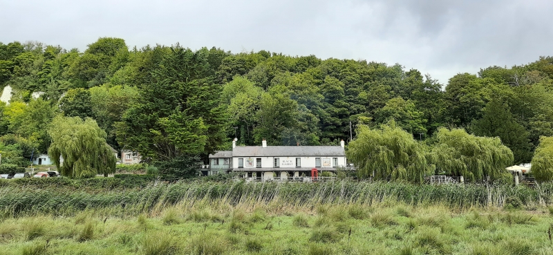
Entry Name: The Black Rabbit Public House
Listing Date: 20 September 1984
Grade: II
Source: Historic England
Source ID: 1274876
English Heritage Legacy ID: 413979
ID on this website: 101274876
Location: Offham, Arun, West Sussex, BN18
County: West Sussex
District: Arun
Civil Parish: South Stoke
Traditional County: Sussex
Lieutenancy Area (Ceremonial County): West Sussex
Church of England Parish: South Stoke St Leonard
Church of England Diocese: Chichester
Tagged with: Pub
TQ OONW SOUTH STOKE
9/240
The Black Rabbit Public
House
II
Early C19. Two storeys. Six windows. Stuccoed. Slate roof. Glazing bars intact
Veranda on ground floor with wooden uprights, curved braces and slate roof.
Listing NGR: TQ0258008493
External links are from the relevant listing authority and, where applicable, Wikidata. Wikidata IDs may be related buildings as well as this specific building. If you want to add or update a link, you will need to do so by editing the Wikidata entry.


Other nearby listed buildings
