Approximate Location Map
Large Map »
Latitude: 51.0273 / 51°1'38"N
Longitude: 0.4939 / 0°29'38"E
OS Eastings: 574982
OS Northings: 128282
OS Grid: TQ749282
Mapcode National: GBR PV2.KPL
Mapcode Global: FRA C6XD.J7L
Plus Code: 9F322FGV+WH
Entry Name: Barn at Merriments Farm to South West of the Farmhouse
Listing Date: 13 May 1987
Grade: II
Source: Historic England
Source ID: 1276237
English Heritage Legacy ID: 409983
ID on this website: 101276237
Location: Rother, East Sussex, TN19
County: East Sussex
District: Rother
Civil Parish: Hurst Green
Traditional County: Sussex
Lieutenancy Area (Ceremonial County): East Sussex
Church of England Parish: Salehurst St Mary
Church of England Diocese: Chichester
Tagged with: Barn
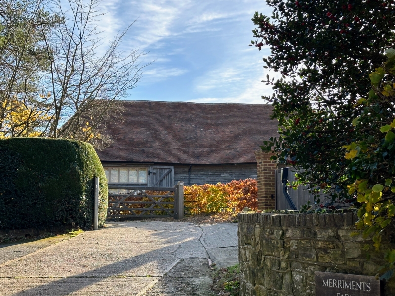
TQ 72 NW HURST GREEN MERRIMENTS LANE
5/17 Barn at Merriments Farm
to south west of the
farmhouse
II
C16 barn, rebuilt in the late C17. Faced with weather-boarding. Hipped tiled
roof.
Listing NGR: TQ7498228282
External links are from the relevant listing authority and, where applicable, Wikidata. Wikidata IDs may be related buildings as well as this specific building. If you want to add or update a link, you will need to do so by editing the Wikidata entry.


Other nearby listed buildings
