Approximate Location Map
Large Map »
Latitude: 50.7739 / 50°46'25"N
Longitude: -1.1411 / 1°8'28"W
OS Eastings: 460657
OS Northings: 97494
OS Grid: SZ606974
Mapcode National: GBR 9C3.D9Y
Mapcode Global: FRA 87H1.H81
Plus Code: 9C2WQVF5+GH
Entry Name: Fort Gilkicker
Listing Date: 20 April 1983
Grade: II*
Source: Historic England
Source ID: 1276716
English Heritage Legacy ID: 408680
Also known as: Gilkicker fort
ID on this website: 101276716
Location: Gosport, Hampshire, PO12
County: Hampshire
District: Gosport
Electoral Ward/Division: Anglesey
Parish: Non Civil Parish
Built-Up Area: Gosport
Traditional County: Hampshire
Lieutenancy Area (Ceremonial County): Hampshire
Church of England Parish: Alverstoke St Mary
Church of England Diocese: Portsmouth
Tagged with: Fort Palmerston fort
SZ 69 NW FORT ROAD (off), Gilkicker
Point
1137/4/43 Fort Gilkicker
20.4.83
II*
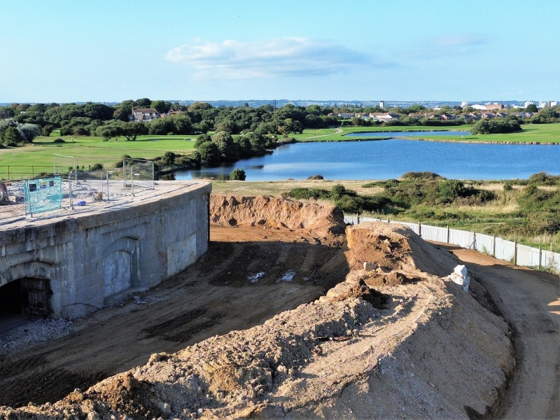
Circa 1865- 71. Built as a result of the 1860 Royal Commission on the Defence of the UK, this is the site of an earlier battery. The present structure is semi-circular, facing southwards to protect the fleet anchorage. The diameter line of the gorge being marked by a narrow barrack block, with a central entrance. On the ground floor there is a series of vaulted ammunition stores, with passages on the outer and inner sides for ventilation and access, all protected by thick outer walls. The first floor level comprises 22 casemates, linked by a continuous wide passageway, all covered by groined vaulting; the floor is solid with traces of curved rails. The middle section has a timber floor, and some casemates contain a chimney breast; at intervals an access between 2 casemates leads io a spiral staircase, which descends to the lower passageway. Between the middle section and the open rear is a glazed screen with a central door. The innermost section is an open verandah, with a continuous passageway on its inner side. The interior face is in red brickwork, the cambered arches of the end of the vaults being supported on granite piers at the casemate level. The brick segmental vaulting converges towards the gun-ports (now walled up). Above the casemates is an open battery, of slightly later date (of 2 periods), containing the surviving features of 3 smaller (part of 5 original) and 2 larger (ie later) gun emplacements, all being circular sinks within a concrete surface. The central position now has a modern brick and concrete superstructure, which is a coastguard station. The outer face is an earthwork which now masks the loopholes of the casemate stage, the granite walling of the outer face being exposed on the return (north face) at each end of the curve. There are external staircases, vents, interior hoists, specially detailed lamp positions, and other smaller features. Across the inner courtyard the cement-faced 2-storeyed barrack block is of domestic scale, with a mon-pitch roof and a series of sash windows, with doors at intervals on the ground floor. On the north (outer) side the parapet line of the fort is continued at the same height, the blank wall having a series of rifle loops at the first floor level. At about the centre is the round-arched gateway, which is formed in granite with an outer hood mould and with inner roll mouldings resting on a detached shaft again with simple classical detail. On the north side are 4 two-storeyed later outshuts, in red brickwork. The structure illustrates the problems of obsolescence, brought about by rapid changes in armament technology; within some 30 years the fort was built and equipped, altered and re-equipped, and became useless (and apparently never used).
Listing NGR: SU5870301371
External links are from the relevant listing authority and, where applicable, Wikidata. Wikidata IDs may be related buildings as well as this specific building. If you want to add or update a link, you will need to do so by editing the Wikidata entry.


Other nearby listed buildings
