Approximate Location Map
Large Map »
Latitude: 51.499 / 51°29'56"N
Longitude: -0.1568 / 0°9'24"W
OS Eastings: 528037
OS Northings: 179393
OS Grid: TQ280793
Mapcode National: GBR 8J.ZT
Mapcode Global: VHGQZ.7LG7
Plus Code: 9C3XFRXV+H7
Entry Name: 2-12 Halkin Arcade and 27 and 28 Motcomb Street and 11A West Halkin Street
Listing Date: 1 December 1987
Grade: II
Source: Historic England
Source ID: 1279385
English Heritage Legacy ID: 210004
ID on this website: 101279385
Location: Belgravia, Westminster, London, SW1X
County: London
District: City of Westminster
Electoral Ward/Division: Knightsbridge and Belgravia
Parish: Non Civil Parish
Built-Up Area: City of Westminster
Traditional County: Middlesex
Lieutenancy Area (Ceremonial County): Greater London
Church of England Parish: St Paul Knightsbridge
Church of England Diocese: London
Tagged with: Building
TQ 2879 SW
97/10
CITY OF WESTMINSTER
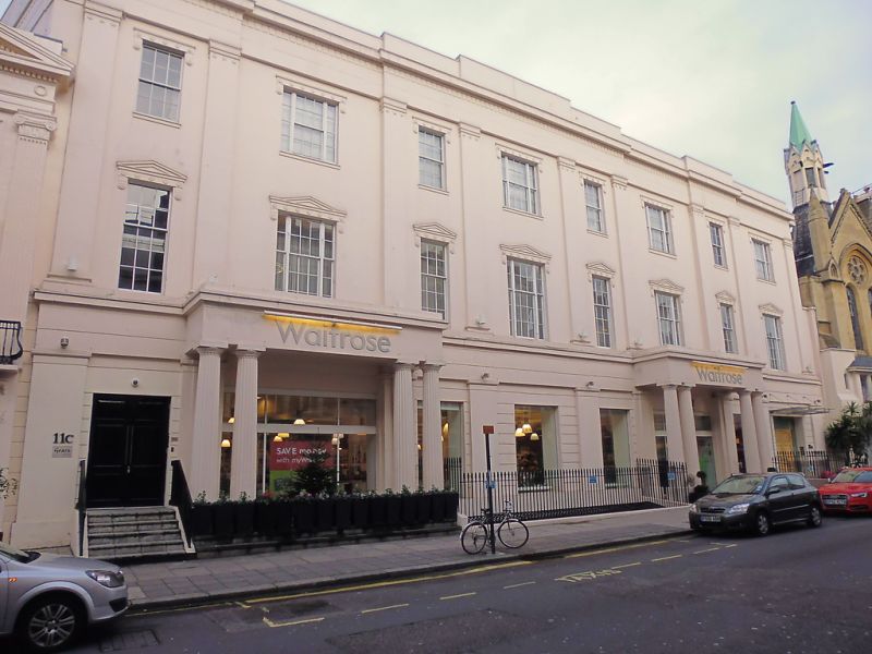
HALKIN ARCADE, SW1
Nos 2 to 12 (consec) including 27 and 28 Motcomb Street and 11a West Halkin Street
GV
II
Shopping arcade. Circa 1830. Stucco, roof not visible. 3 storeys. 8 bays.
First, third, fourth, fifth and seventh bays set forward slightly. Greek Doric
porch with coupled columns to fourth bay. Ground floor with windows probably
widened. Square headed windows. Sashes. Glazing bars. Corniced windows with
rosettes to frieze, those to first floor pedimented. Giant order of pilasters
linking first and second floors between bays. Cornice probably simplified.
Parapet. Rear to Motcomb Street also of interest with three storey arched
windows, designed to provide light to former first floor bazaars.
London. Vol. I. N Pevsner.
Listing NGR: TQ2803779393
External links are from the relevant listing authority and, where applicable, Wikidata. Wikidata IDs may be related buildings as well as this specific building. If you want to add or update a link, you will need to do so by editing the Wikidata entry.


Other nearby listed buildings
