Approximate Location Map
Large Map »
Latitude: 52.3638 / 52°21'49"N
Longitude: -2.7172 / 2°43'2"W
OS Eastings: 351257
OS Northings: 274215
OS Grid: SO512742
Mapcode National: GBR BK.SCPY
Mapcode Global: VH843.VVC8
Plus Code: 9C4V977M+G4
Entry Name: Ludford Bridge
Listing Date: 12 November 1954
Grade: I
Source: Historic England
Source ID: 1281983
English Heritage Legacy ID: 389679
ID on this website: 101281983
Location: Ludford, Shropshire, SY8
County: Shropshire
Civil Parish: Ludford
Built-Up Area: Ludlow
Traditional County: Herefordshire
Lieutenancy Area (Ceremonial County): Shropshire
Church of England Parish: Ludford
Church of England Diocese: Hereford
Tagged with: Road bridge
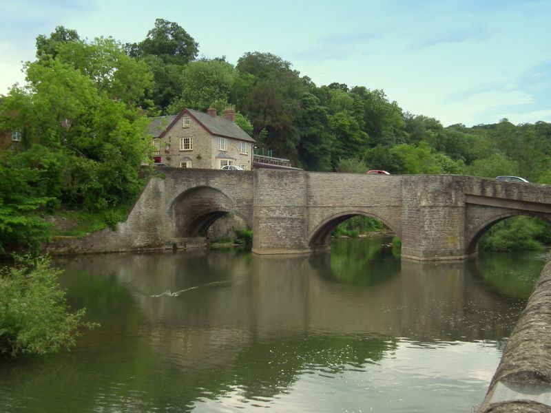
LUDFORD
SO5174
825-1/1/57
Ludford Bridge
12/11/54
I
Bridge over River Teme. C15, restored 1886. Dressed stone with rubble superstructure and ashlar coping. Three arches with broad ribs; deep cut-waters with chamfered bands, and large refuges over; stone band to east side. C20 alterations to north end.
This entry was subject to a Minor Amendment on 11 October 2017.
External links are from the relevant listing authority and, where applicable, Wikidata. Wikidata IDs may be related buildings as well as this specific building. If you want to add or update a link, you will need to do so by editing the Wikidata entry.


Other nearby listed buildings
