Approximate Location Map
Large Map »
Latitude: 53.5611 / 53°33'39"N
Longitude: -1.8106 / 1°48'38"W
OS Eastings: 412641
OS Northings: 407182
OS Grid: SE126071
Mapcode National: GBR HWS8.T5
Mapcode Global: WHCBF.5R2C
Plus Code: 9C5WH56Q+CQ
Entry Name: 26, 28, Fairfields Road
Listing Date: 4 August 1983
Grade: II
Source: Historic England
Source ID: 1287710
English Heritage Legacy ID: 340317
ID on this website: 101287710
Location: Holmbridge, Kirklees, West Yorkshire, HD9
County: Kirklees
Civil Parish: Holme Valley
Built-Up Area: Holmfirth
Traditional County: Yorkshire
Lieutenancy Area (Ceremonial County): West Yorkshire
Church of England Parish: Holmbridge St David
Church of England Diocese: Leeds
Tagged with: Building
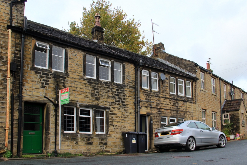
SE 10 NW FAIRFIELDS ROAD
4/90 (Hinchliffe Mill)
Nos 26 and 28
II
Part of row. Early to mid Cl9. Hammer dressed stone. Stone slate roof. Central
ashlar stack. Occasional stone brackets. Two storeys. Each dwelling has entrance
and one 3-light stone mullioned window to ground floor and one 3-light and one 2-light
window to first floor.
Listing NGR: SE1264107181
External links are from the relevant listing authority and, where applicable, Wikidata. Wikidata IDs may be related buildings as well as this specific building. If you want to add or update a link, you will need to do so by editing the Wikidata entry.


Other nearby listed buildings
