Approximate Location Map
Large Map »
Latitude: 51.2101 / 51°12'36"N
Longitude: -3.481 / 3°28'51"W
OS Eastings: 296646
OS Northings: 146698
OS Grid: SS966466
Mapcode National: GBR LJ.41YS
Mapcode Global: VH5JY.MV36
Plus Code: 9C3R6G69+2J
Entry Name: Nos 15 and 17 and Attached Wall and Gate Nos 15 and 17 Vicarage Road and Attached Wall and Gate
Listing Date: 4 July 1952
Last Amended: 30 September 1994
Grade: II
Source: Historic England
Source ID: 1293337
English Heritage Legacy ID: 391261
ID on this website: 101293337
Location: Higher Town, Somerset, TA24
County: Somerset
District: Somerset West and Taunton
Civil Parish: Minehead
Built-Up Area: Minehead
Traditional County: Somerset
Lieutenancy Area (Ceremonial County): Somerset
Tagged with: Building Thatched cottage
MINEHEAD
SS9646 VICARAGE ROAD
900-1/3/102 (South East side)
04/07/52 Nos.15 AND 17
and attached wall and gate
(Formerly Listed as:
VICARAGE ROAD
(South East side)
Nos.15 AND 17)
GV II
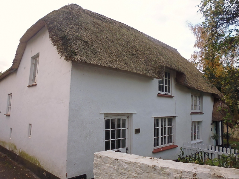
2 cottages. C18. Painted render over cob and rubblestone,
half-hipped thatched roof with brick stack to centre ridge.
One-unit plans, No.15 has a 2-storey rear wing and No.17 a
rear outshut.
2 storeys; each cottage is one-window range. C20 doors to the
outer ends and 2- and 3-light casement windows, that to the
first-floor of No.15 to the left is in a half dormer. No.17
has a C20 semi-conical thatched porch. On left return (in
Church Street) there is a 2-light casement window with 2 small
single lights to the ground floor.
INTERIORS not inspected.
SUBSIDIARY FEATURES: a rubblestone wall approx 1m high,
attached to the left of No.15, curves forward to enclose the
front gardens; an early C19 iron gate with fleur-de-lys heads
to long/short railings is attached to the rear wing in Church
Street where a rubblestone wall sweeps up to 2m, continues for
approx 15m, and is attached to a workshop of No.13 Church
Street (qv).
Listing NGR: SS9664646698
External links are from the relevant listing authority and, where applicable, Wikidata. Wikidata IDs may be related buildings as well as this specific building. If you want to add or update a link, you will need to do so by editing the Wikidata entry.


Other nearby listed buildings
