Approximate Location Map
Large Map »
Latitude: 51.0571 / 51°3'25"N
Longitude: -1.3126 / 1°18'45"W
OS Eastings: 448269
OS Northings: 128862
OS Grid: SU482288
Mapcode National: GBR 861.QXX
Mapcode Global: FRA 864B.8FC
Plus Code: 9C3W3M4P+RW
Entry Name: College Mill St Mary's College
Listing Date: 14 January 1974
Grade: II
Source: Historic England
Source ID: 1296819
English Heritage Legacy ID: 144550
ID on this website: 101296819
Location: The Close, Winchester, Hampshire, SO23
County: Hampshire
District: Winchester
Electoral Ward/Division: St Michael
Parish: Non Civil Parish
Built-Up Area: Winchester
Traditional County: Hampshire
Lieutenancy Area (Ceremonial County): Hampshire
Tagged with: Mill building
1.
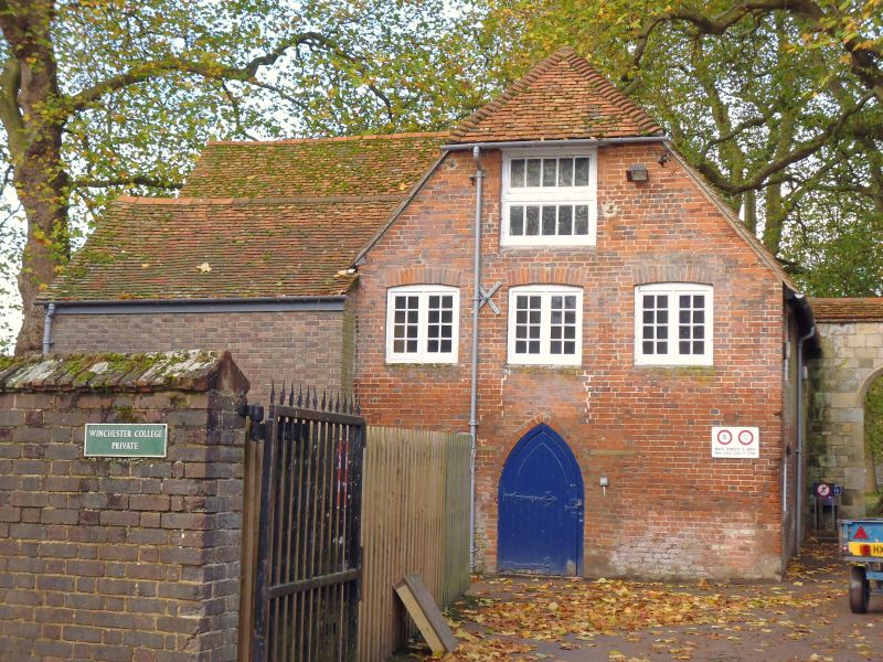
1833 COLLEGE STREET
(South Side)
St Mary's College.
College Mill
SU 4828 NW 8/331
II GV
2.
C19. Red brick, two storeys. Modern two and three-light casement windows.
Tiled roof with gables. Altered and modernized but listed for group value.
All the listed buildings in College Street form a group.
Listing NGR: SU4826829006
External links are from the relevant listing authority and, where applicable, Wikidata. Wikidata IDs may be related buildings as well as this specific building. If you want to add or update a link, you will need to do so by editing the Wikidata entry.


Other nearby listed buildings
