Approximate Location Map
Large Map »
Latitude: 52.6912 / 52°41'28"N
Longitude: -0.6328 / 0°37'58"W
OS Eastings: 492500
OS Northings: 311268
OS Grid: SK925112
Mapcode National: GBR DSV.8TM
Mapcode Global: WHGLN.7MW6
Plus Code: 9C4XM9R8+FV
Entry Name: 1, High Street
Listing Date: 14 June 1954
Grade: II
Source: Historic England
Source ID: 1307259
English Heritage Legacy ID: 187358
ID on this website: 101307259
Location: Exton, Rutland, LE15
County: Rutland
Civil Parish: Exton and Horn
Built-Up Area: Exton
Traditional County: Rutland
Lieutenancy Area (Ceremonial County): Rutland
Church of England Parish: Exton with Horn St Peter and St Paul
Church of England Diocese: Peterborough
Tagged with: Building
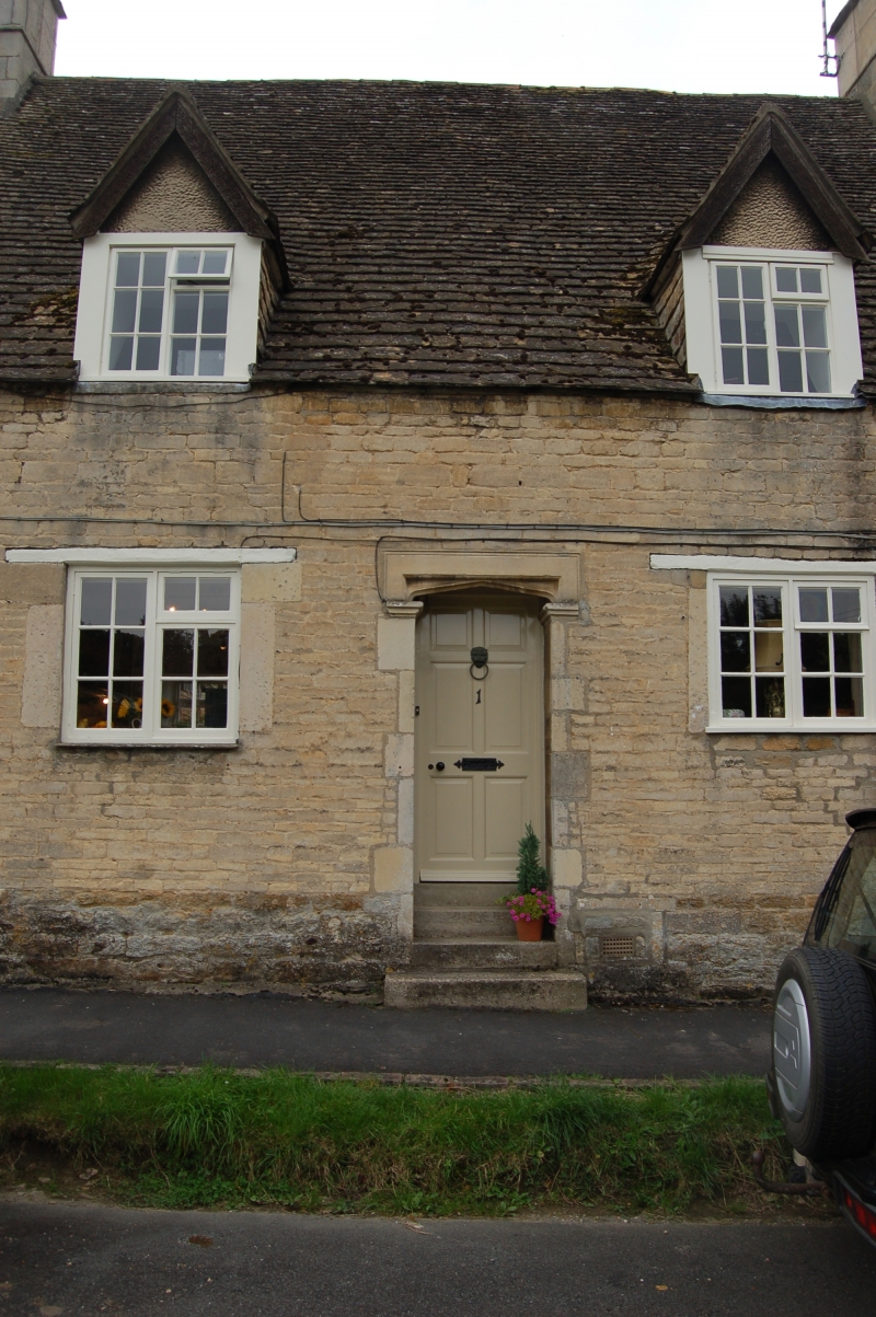
SK 9211 - 9311 EXTON HIGH STREET (east side)
5/73 No. 1
14.6.54
GV II
Cottage, probably late C17 with earlier core, and facade altered in
early C20. Coursed rubble with steeply coped gables. Stone tiled
roof. 2 unit plan with central door in 4-centred arch. Windows have
been renewed in original openings. 2 C20 gabled dormers above with
carved wood bargeboards.
Listing NGR: SK9250011268
External links are from the relevant listing authority and, where applicable, Wikidata. Wikidata IDs may be related buildings as well as this specific building. If you want to add or update a link, you will need to do so by editing the Wikidata entry.


Other nearby listed buildings
