Approximate Location Map
Large Map »
Latitude: 51.6485 / 51°38'54"N
Longitude: -0.7624 / 0°45'44"W
OS Eastings: 485720
OS Northings: 195138
OS Grid: SU857951
Mapcode National: GBR D4Y.L28
Mapcode Global: VHDVY.QTSM
Plus Code: 9C3XJ6XQ+C2
Entry Name: Barn South West of Hughenden Manor Farmhouse
Listing Date: 9 January 1954
Grade: II
Source: Historic England
Source ID: 1310831
English Heritage Legacy ID: 46004
ID on this website: 101310831
Location: Downley, Buckinghamshire, HP13
County: Buckinghamshire
Electoral Ward/Division: Disraeli
Parish: Non Civil Parish
Traditional County: Buckinghamshire
Lieutenancy Area (Ceremonial County): Buckinghamshire
Church of England Parish: Hughenden
Church of England Diocese: Oxford
Tagged with: Barn
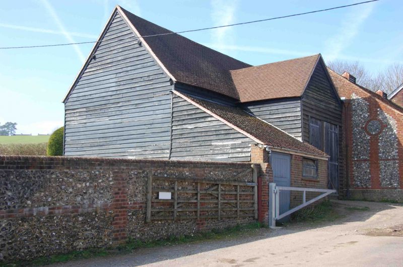
COATES LANE
1.
963
Barn South West of
Hughenden Manor Farmhouse
(Formerly listed
under Hughenden)
SU 89 NE 8/235 9.1.54.
II GV
2.
C17 or C18. Weatherboards, old tiled roofs. T plan, red brick base to
walls.
Hughenden Manor Farmhouse and Barns form a group.
Listing NGR: SU8572095138
External links are from the relevant listing authority and, where applicable, Wikidata. Wikidata IDs may be related buildings as well as this specific building. If you want to add or update a link, you will need to do so by editing the Wikidata entry.


Other nearby listed buildings
