Approximate Location Map
Large Map »
Latitude: 50.215 / 50°12'54"N
Longitude: -5.4807 / 5°28'50"W
OS Eastings: 151775
OS Northings: 40802
OS Grid: SW517408
Mapcode National: GBR DXV3.N97
Mapcode Global: VH12D.YVDJ
Plus Code: 9C2P6G89+2P
Entry Name: 17, 19 and 21, Digey Street
Listing Date: 22 December 1972
Grade: II
Source: Historic England
Source ID: 1312621
English Heritage Legacy ID: 68970
ID on this website: 101312621
Location: St Ives, Cornwall, TR26
County: Cornwall
Civil Parish: St. Ives
Built-Up Area: St Ives
Traditional County: Cornwall
Lieutenancy Area (Ceremonial County): Cornwall
Church of England Parish: St Ives
Church of England Diocese: Truro
Tagged with: Building
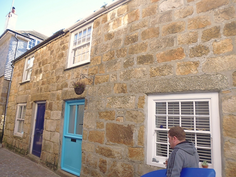
DIGEY STREET
1. (South-west Side)
1587 -----------------
Nos 17, 19 and 21
SW 54 SW 1/64
II GV
2.
C18/19 cottages, coursed granite, No 21 painted. Two storeys, four
windows overall, sashes; no glazing bars, Modern glazed doors. Slurried
slate roof with half-hipped ends. Group value.
Nos 17, 19 21 and St Eia, form a group.
Listing NGR: SW5177540802
External links are from the relevant listing authority and, where applicable, Wikidata. Wikidata IDs may be related buildings as well as this specific building. If you want to add or update a link, you will need to do so by editing the Wikidata entry.


Other nearby listed buildings
