Approximate Location Map
Large Map »
Latitude: 54.7725 / 54°46'21"N
Longitude: -1.5716 / 1°34'17"W
OS Eastings: 427658
OS Northings: 542040
OS Grid: NZ276420
Mapcode National: GBR KFG7.KZ
Mapcode Global: WHC4Q.T9TN
Plus Code: 9C6WQCFH+29
Entry Name: 29B, Church Street
Listing Date: 30 April 1971
Last Amended: 10 March 1988
Grade: II
Source: Historic England
Source ID: 1323233
English Heritage Legacy ID: 110102
ID on this website: 101323233
Location: The Sands, County Durham, DH1
County: County Durham
Electoral Ward/Division: Elvet and Gilesgate
Parish: City of Durham
Built-Up Area: Durham
Traditional County: Durham
Lieutenancy Area (Ceremonial County): County Durham
Church of England Parish: Durham St Oswald
Church of England Diocese: Durham
Tagged with: Building
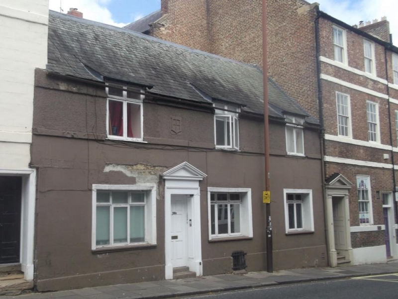
DURHAM AND FRAMWELLGATE CHURCH STREET
NZ 2742 SE (West side)
15/53 No. 29B (formerly
listed as No. 28B)
30.4.71
GV II
House, now flats. Late C17/early C18. Painted incised stucco ground floor,
painted pebble-dash render above, with painted ashlar plinth and dressings.
Roof of graduated Lakeland slates with brick chimney. 2 storeys, the second
low; 3 bays.
6-panel door between first and second windows, in panelled reveal with pedimented
architrave. 3-light C20 transomed windows on ground floor in deep reveals and
architraves with thin sills. Cross windows above have sill bands and break eaves
slightly. Roof rises over windows. Left end chimney. Durham coat of arms above
door. Marked No 28b on OS map.
Listing NGR: NZ2765242054
External links are from the relevant listing authority and, where applicable, Wikidata. Wikidata IDs may be related buildings as well as this specific building. If you want to add or update a link, you will need to do so by editing the Wikidata entry.


Other nearby listed buildings
