Approximate Location Map
Large Map »
Latitude: 50.7329 / 50°43'58"N
Longitude: -1.775 / 1°46'29"W
OS Eastings: 415975
OS Northings: 92616
OS Grid: SZ159926
Mapcode National: GBR 55B.VFZ
Mapcode Global: FRA 7754.NB9
Plus Code: 9C2WP6MG+52
Entry Name: Church Hatch
Listing Date: 14 October 1953
Grade: II*
Source: Historic England
Source ID: 1324652
English Heritage Legacy ID: 101487
ID on this website: 101324652
Location: Wick, Bournemouth, Christchurch and Poole, Dorset, BH23
County: Bournemouth, Christchurch and Poole
Parish: Christchurch
Built-Up Area: Christchurch
Traditional County: Hampshire
Lieutenancy Area (Ceremonial County): Dorset
Church of England Parish: Christchurch Holy Trinity
Church of England Diocese: Winchester
Tagged with: Architectural structure
CHURCH STREET
1. (East Side)
5187
No 13
(Church Hatch)
SZ 1592 1A/7 14.10.53.
II* GV
2.
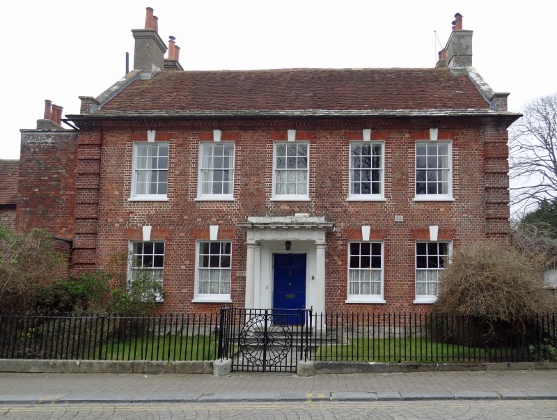
C18. Red brick, all headers with rusticated brick quoin bands flanking the
facade. Eaves cornice. Tiled roof with stone verges and coped gable ends.
2 storeys, 5 windows; sashes with glazing bars. 3 steps approach porch with
Doric columns and triglyph frieze. 6 panelled door with panelled reveals. Recessed
wing to north-west.
Nos 10 to 13 (consec) (with its railings and wall), form a group with Nos 14
to 16 (consec) with associated wall and with the Priory Church, the gates to
the churchyard, the sundial and boundary walls to churchyard and Garden of
Rememberance.
Listing NGR: SZ1596892628
External links are from the relevant listing authority and, where applicable, Wikidata. Wikidata IDs may be related buildings as well as this specific building. If you want to add or update a link, you will need to do so by editing the Wikidata entry.


Other nearby listed buildings
