Approximate Location Map
Large Map »
Latitude: 54.6668 / 54°40'0"N
Longitude: -2.752 / 2°45'7"W
OS Eastings: 351596
OS Northings: 530447
OS Grid: NY515304
Mapcode National: GBR 9G7G.0W
Mapcode Global: WH814.PYRR
Plus Code: 9C6VM68X+P6
Entry Name: Hunter House
Listing Date: 9 February 1983
Grade: II
Source: Historic England
Source ID: 1326907
English Heritage Legacy ID: 72871
ID on this website: 101326907
Location: Penrith, Westmorland and Furness, Cumbria, CA11
County: Cumbria
District: Eden
Civil Parish: Penrith
Built-Up Area: Penrith
Traditional County: Cumberland
Lieutenancy Area (Ceremonial County): Cumbria
Church of England Parish: Penrith St Andrew
Church of England Diocese: Carlisle
Tagged with: House
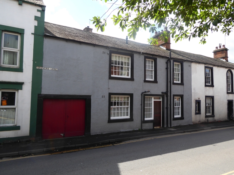
1.
5165 HUNTER'S LANE
No 12 (Hunter House) and No 13
NY 5130 1/111
II
2.
Early C19. Corner of Drover Lane. Roughcast, 2 storeys, stone roof, 2 stone
chimneys. Two modern doors and 2 garage doors in long plan. Five windows on
ground floor and 6 above, with 16 and 24 panes. A round-arched staircase window
with glazing bars.
Listing NGR: NY5159630447
External links are from the relevant listing authority and, where applicable, Wikidata. Wikidata IDs may be related buildings as well as this specific building. If you want to add or update a link, you will need to do so by editing the Wikidata entry.


Other nearby listed buildings
