Approximate Location Map
Large Map »
Latitude: 54.6659 / 54°39'57"N
Longitude: -2.7535 / 2°45'12"W
OS Eastings: 351498
OS Northings: 530349
OS Grid: NY514303
Mapcode National: GBR 9G6H.P6
Mapcode Global: WH814.PZ0G
Plus Code: 9C6VM68W+9J
Entry Name: 17, Queen Street
Listing Date: 9 February 1983
Grade: II
Source: Historic England
Source ID: 1326935
English Heritage Legacy ID: 72916
ID on this website: 101326935
Location: Penrith, Westmorland and Furness, Cumbria, CA11
County: Cumbria
District: Eden
Civil Parish: Penrith
Built-Up Area: Penrith
Traditional County: Cumberland
Lieutenancy Area (Ceremonial County): Cumbria
Church of England Parish: Penrith St Andrew
Church of England Diocese: Carlisle
Tagged with: Building
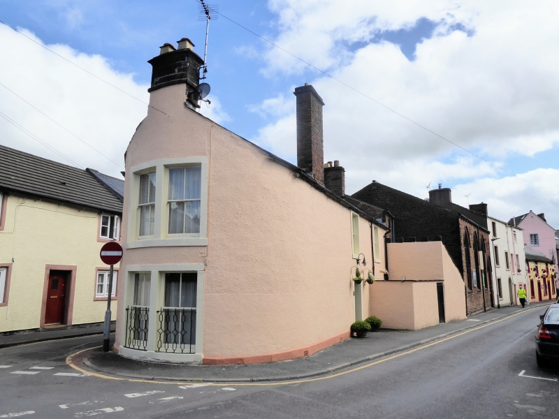
1.
5165 QUEEN STREET
No 17
NY 5130 1/161
II GV
2.
Late C18, on peninsular site with curved end and roof verge sweeping up to
central chimney stack.
Curved end has 1 window in each storey, the lower one with wrought iron grille.
Queen Street front has modern door with 2 sashes above. Albert Street facade
has staircase window and upper sash.
Listing NGR: NY5149830349
External links are from the relevant listing authority and, where applicable, Wikidata. Wikidata IDs may be related buildings as well as this specific building. If you want to add or update a link, you will need to do so by editing the Wikidata entry.


Other nearby listed buildings
