Approximate Location Map
Large Map »
Latitude: 50.2117 / 50°12'42"N
Longitude: -5.482 / 5°28'55"W
OS Eastings: 151668
OS Northings: 40438
OS Grid: SW516404
Mapcode National: GBR DXV3.V0X
Mapcode Global: VH12D.XYR2
Plus Code: 9C2P6G69+M5
Entry Name: 5, 6, 8 and 8A, Street-An-Garrow
Listing Date: 22 December 1972
Grade: II
Source: Historic England
Source ID: 1327804
English Heritage Legacy ID: 69104
ID on this website: 101327804
Location: St Ives, Cornwall, TR26
County: Cornwall
Civil Parish: St. Ives
Built-Up Area: St Ives
Traditional County: Cornwall
Lieutenancy Area (Ceremonial County): Cornwall
Church of England Parish: St Ives
Church of England Diocese: Truro
Tagged with: Building
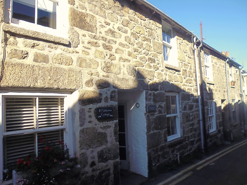
STREET-AN-GARROW
1. (North Side)
1587 ----------------
Nos 5, 6, 8 Bald 8A
SW 54 SW 1/143
II GV
2.
Earlier C19 cottages. Rubble with granite quoins and lintels. Two storeys,
four windows overall, sashes, no glazing bars. Modern glazed doors. Slate
roof. Group value.
Nos 3, 4, 5, 8, 8A, form a group.
Listing NGR: SW5166840438
External links are from the relevant listing authority and, where applicable, Wikidata. Wikidata IDs may be related buildings as well as this specific building. If you want to add or update a link, you will need to do so by editing the Wikidata entry.


Other nearby listed buildings
