Approximate Location Map
Large Map »
Latitude: 52.2011 / 52°12'3"N
Longitude: 0.119 / 0°7'8"E
OS Eastings: 544911
OS Northings: 257990
OS Grid: TL449579
Mapcode National: GBR L79.T3Q
Mapcode Global: VHHK3.0YS0
Plus Code: 9F426429+CJ
Entry Name: Peterhouse, Gates and Piers of the Master's Lodge
Listing Date: 2 November 1972
Grade: I
Source: Historic England
Source ID: 1332192
English Heritage Legacy ID: 47218
ID on this website: 101332192
Location: Cambridge, Cambridgeshire, CB2
County: Cambridgeshire
District: Cambridge
Electoral Ward/Division: Market
Parish: Non Civil Parish
Built-Up Area: Cambridge
Traditional County: Cambridgeshire
Lieutenancy Area (Ceremonial County): Cambridgeshire
Church of England Parish: Cambridge St Mary the Less
Church of England Diocese: Ely
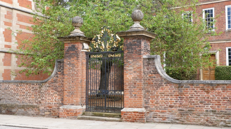
PETERHOUSE
1.
942
Gates and piers of
the Master's Lodge
TL 4457 NE 9/377A
I
2.
2 original red brick piers of 1702 with stone cornices and ball finials.
Later red brick stone capped walls. Wrought iron gates of 1928. (RCHM).
Listing NGR: TL4491157989
External links are from the relevant listing authority and, where applicable, Wikidata. Wikidata IDs may be related buildings as well as this specific building. If you want to add or update a link, you will need to do so by editing the Wikidata entry.


Other nearby listed buildings
