Approximate Location Map
Large Map »
Latitude: 51.2774 / 51°16'38"N
Longitude: 1.0865 / 1°5'11"E
OS Eastings: 615366
OS Northings: 157670
OS Grid: TR153576
Mapcode National: GBR TY2.ZF9
Mapcode Global: VHLGM.S581
Plus Code: 9F3373GP+XJ
Entry Name: 7 and 8, Longport
Listing Date: 3 December 1949
Grade: II
Source: Historic England
Source ID: 1334299
English Heritage Legacy ID: 439684
ID on this website: 101334299
Location: Canterbury, Kent, CT1
County: Kent
District: Canterbury
Electoral Ward/Division: Barton
Parish: Non Civil Parish
Built-Up Area: Canterbury
Traditional County: Kent
Lieutenancy Area (Ceremonial County): Kent
Tagged with: Building
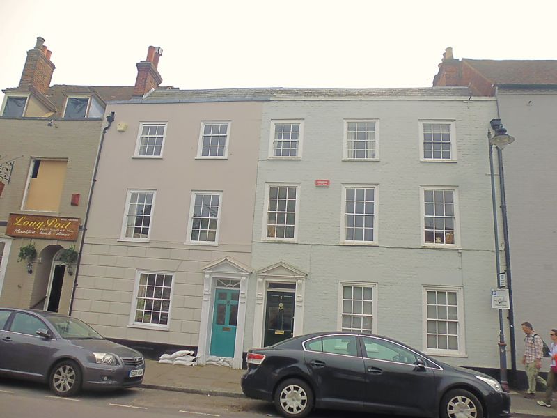
1.
944 LONGP0RT
(South Side)
Nos 7 & 8
TR 1557 NW 5/157 3.12.49.
II GV
2.
Late C18 to early C19. 3 storeys. No 7 is painted brick. No 8 is stuccoed,
with a rusticated base. Slate roof with coping. 5 sashes with verticals only.
Ground floor has doorcases with pediments, console brackets, rectangular fanlights
and 6 panelled doors.
Nos 6A to 9 (consec) form a group.
Listing NGR: TR1536557666
External links are from the relevant listing authority and, where applicable, Wikidata. Wikidata IDs may be related buildings as well as this specific building. If you want to add or update a link, you will need to do so by editing the Wikidata entry.


Other nearby listed buildings
