Approximate Location Map
Large Map »
Latitude: 51.2823 / 51°16'56"N
Longitude: 1.0804 / 1°4'49"E
OS Eastings: 614913
OS Northings: 158187
OS Grid: TR149581
Mapcode National: GBR TY2.HYD
Mapcode Global: VHLGM.P10B
Plus Code: 9F3373JJ+W4
Entry Name: 2 and 3, Mill Lane
Listing Date: 7 September 1973
Grade: II
Source: Historic England
Source ID: 1334331
English Heritage Legacy ID: 439781
ID on this website: 101334331
Location: Canterbury, Kent, CT1
County: Kent
District: Canterbury
Electoral Ward/Division: Westgate
Parish: Non Civil Parish
Built-Up Area: Canterbury
Traditional County: Kent
Lieutenancy Area (Ceremonial County): Kent
Tagged with: Building
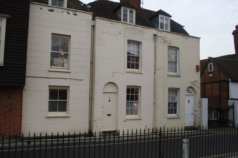
1.
944 MILL LANE
(East Side)
Nos 2 & 3
TR 1458 SE 2/566
II GV
2.
A late C18 pair. 2 storeys painted brick. Half hipped old tiled roof with
2 hipped dormers. Stone coping. Rainwater head, 1 cambered sash with verticals
only to No 3. 2 round-headed doorcases with restored dormers,
Nos 2 to 12 (consec) form a group.
Listing NGR: TR1491558184
External links are from the relevant listing authority and, where applicable, Wikidata. Wikidata IDs may be related buildings as well as this specific building. If you want to add or update a link, you will need to do so by editing the Wikidata entry.


Other nearby listed buildings
