Approximate Location Map
Large Map »
Latitude: 51.2788 / 51°16'43"N
Longitude: 1.0808 / 1°4'50"E
OS Eastings: 614957
OS Northings: 157808
OS Grid: TR149578
Mapcode National: GBR TY2.Q23
Mapcode Global: VHLGM.P36Z
Plus Code: 9F3373HJ+G8
Entry Name: 11, Mercery Lane
Listing Date: 3 May 1967
Grade: II
Source: Historic England
Source ID: 1334344
English Heritage Legacy ID: 439762
ID on this website: 101334344
Location: Canterbury, Kent, CT1
County: Kent
District: Canterbury
Electoral Ward/Division: Westgate
Parish: Non Civil Parish
Built-Up Area: Canterbury
Traditional County: Kent
Lieutenancy Area (Ceremonial County): Kent
Tagged with: Building
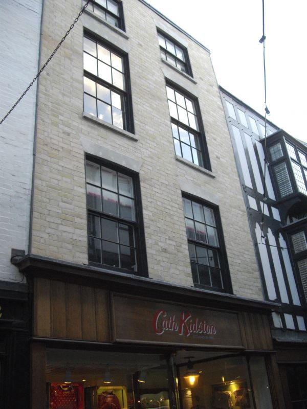
1.
944 MERCERY LANE
(East Side)
No 11
TR 1457 NE 4/266 3.5.67.
II GV
2.
C18. 4 storeys painted brick. Parapet with stone coping. 2 sashes with glazing
bars intact. Stone heads and cills. Later C19 shopfront.
Nos 1 to 8A (consec), Nos 10 to 16 (consec), Nos 38 to 44 (consec) Burgate
together with Nos 1 to 9 (consec) Butchery Lane form a group.
Also Nos 10 to 16 (consec) form a group together with Nos 6A & 7 The Parade.
Listing NGR: TR1495757808
External links are from the relevant listing authority and, where applicable, Wikidata. Wikidata IDs may be related buildings as well as this specific building. If you want to add or update a link, you will need to do so by editing the Wikidata entry.


Other nearby listed buildings
