Approximate Location Map
Large Map »
Latitude: 51.4443 / 51°26'39"N
Longitude: 0.2187 / 0°13'7"E
OS Eastings: 554285
OS Northings: 174039
OS Grid: TQ542740
Mapcode National: GBR TN.RT1
Mapcode Global: VHHNT.QYZN
Plus Code: 9F32C6V9+PF
Entry Name: 44, High Street
Listing Date: 25 September 1975
Grade: II
Source: Historic England
Source ID: 1336370
English Heritage Legacy ID: 172122
ID on this website: 101336370
Location: New Town, Dartford, Kent, DA1
County: Kent
District: Dartford
Electoral Ward/Division: Town
Parish: Non Civil Parish
Built-Up Area: Bexley
Traditional County: Kent
Lieutenancy Area (Ceremonial County): Kent
Church of England Parish: Dartford Holy Trinity
Church of England Diocese: Rochester
Tagged with: Building
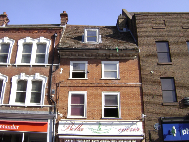
1. HIGH STREET
5274 (North Side)
No 44
TQ 5474 2/5
II GV
2.
Early C18. 3 storeys and attics red brick. Tiled roof with 1 dormer end heavy
wooden modillion eaves cornice. Stringcourse above lst floor. 2 sashes with glazing
bars missing. Modern shop front.
Group value with Nos 46 and 48 which are of local interest.
Listing NGR: TQ5428574039
External links are from the relevant listing authority and, where applicable, Wikidata. Wikidata IDs may be related buildings as well as this specific building. If you want to add or update a link, you will need to do so by editing the Wikidata entry.


Other nearby listed buildings
