Approximate Location Map
Large Map »
Latitude: 51.2793 / 51°16'45"N
Longitude: 1.0792 / 1°4'45"E
OS Eastings: 614849
OS Northings: 157855
OS Grid: TR148578
Mapcode National: GBR TY2.PPP
Mapcode Global: VHLGM.N3DM
Plus Code: 9F3373HH+PM
Entry Name: 35, High Street
Listing Date: 7 September 1973
Grade: II
Source: Historic England
Source ID: 1336847
English Heritage Legacy ID: 170653
ID on this website: 101336847
Location: Canterbury, Kent, CT1
County: Kent
District: Canterbury
Electoral Ward/Division: Westgate
Parish: Non Civil Parish
Built-Up Area: Canterbury
Traditional County: Kent
Lieutenancy Area (Ceremonial County): Kent
Tagged with: Building
1.
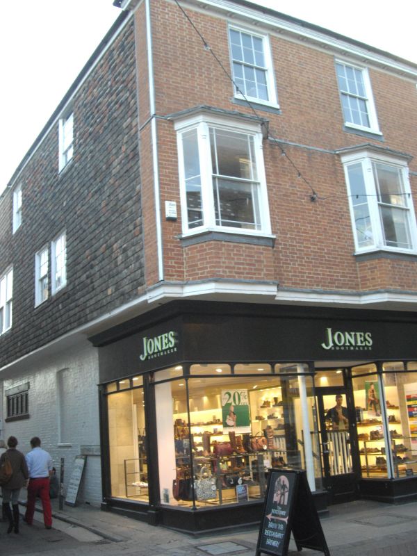
944 HIGH STREET
(South West Side)
No 35
TR 1457 NE 4/511
II GV
2.
Early C19. 3 storeys painted brick, Hipped tiled roof with wide bracket
cornice. 2 sashes with glazing bars intact. lst floor has 2 canted bays.
Later shop front.
Forms a group with No 10 Whitehorse Lane.
Listing NGR: TR1484157846
External links are from the relevant listing authority and, where applicable, Wikidata. Wikidata IDs may be related buildings as well as this specific building. If you want to add or update a link, you will need to do so by editing the Wikidata entry.


Other nearby listed buildings
