Approximate Location Map
Large Map »
Latitude: 51.3539 / 51°21'14"N
Longitude: 1.0258 / 1°1'32"E
OS Eastings: 610778
OS Northings: 165996
OS Grid: TR107659
Mapcode National: GBR TX7.24P
Mapcode Global: VHKJR.Q7NF
Plus Code: 9F33923G+H8
Entry Name: 17-25, Canterbury Road
Listing Date: 23 December 1975
Grade: II
Source: Historic England
Source ID: 1336856
English Heritage Legacy ID: 170800
ID on this website: 101336856
Location: Whitstable, Canterbury, Kent, CT5
County: Kent
District: Canterbury
Electoral Ward/Division: Gorrell
Parish: Non Civil Parish
Built-Up Area: Whitstable
Traditional County: Kent
Lieutenancy Area (Ceremonial County): Kent
Tagged with: Building
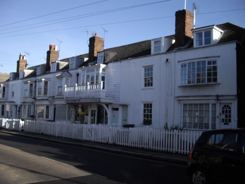
CANTERBURY ROAD
1.
5275
(South East Side)
Nos 17 to 25 (odd)
TR 1066 SE 2/20A
TR 16 NW 4/20A 25.12.75.
II GV
2.
Part of same range as Nos 11-15 (odd) circa 1830-40. No 17 rendered front; Nos
19-25 have been pebbledashed. No 23 retains box sashes complete. Nos 17 and 19
retain bay windows 1st floor. Slate roofs, parapet. No 25 modern concrete tiled
roof. All houses very much altered.
Listing NGR: TR1077865996
External links are from the relevant listing authority and, where applicable, Wikidata. Wikidata IDs may be related buildings as well as this specific building. If you want to add or update a link, you will need to do so by editing the Wikidata entry.


Other nearby listed buildings
