Approximate Location Map
Large Map »
Latitude: 52.2092 / 52°12'33"N
Longitude: 0.1381 / 0°8'17"E
OS Eastings: 546189
OS Northings: 258932
OS Grid: TL461589
Mapcode National: GBR L79.KQC
Mapcode Global: VHHK3.BQWS
Plus Code: 9F42645Q+M6
Entry Name: Wall at Abbey House Fronting Abbey Road and Beche Road
Listing Date: 2 November 1972
Grade: II
Source: Historic England
Source ID: 1338182
English Heritage Legacy ID: 47316
ID on this website: 101338182
Location: Cambridge, Cambridgeshire, CB5
County: Cambridgeshire
District: Cambridge
Electoral Ward/Division: Abbey
Parish: Non Civil Parish
Built-Up Area: Cambridge
Traditional County: Cambridgeshire
Lieutenancy Area (Ceremonial County): Cambridgeshire
Church of England Parish: Cambridge St Andrew the Less
Church of England Diocese: Ely
Tagged with: Wall
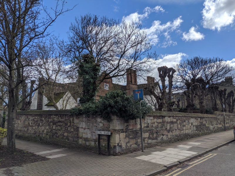
ABBEY ROAD
1.
942
Wall at Abbey House
fronting Abbey Road
& Beche Road
TL 45 NE 21/17A
II
2.
Probably C18. Stone wall with some brick inset; brick coping. Two pairs
of stone gate piers with ball finials.
Listing NGR: TL4618958932
External links are from the relevant listing authority and, where applicable, Wikidata. Wikidata IDs may be related buildings as well as this specific building. If you want to add or update a link, you will need to do so by editing the Wikidata entry.


Other nearby listed buildings
