Approximate Location Map
Large Map »
Latitude: 51.445 / 51°26'41"N
Longitude: 0.3658 / 0°21'57"E
OS Eastings: 564507
OS Northings: 174432
OS Grid: TQ645744
Mapcode National: GBR NMK.99N
Mapcode Global: VHJLC.9Y84
Plus Code: 9F32C9V8+X8
Entry Name: 44, West Street
Listing Date: 3 July 1975
Grade: II
Source: Historic England
Source ID: 1341515
English Heritage Legacy ID: 356440
ID on this website: 101341515
Location: Gravesend, Gravesham, Kent, DA11
County: Kent
District: Gravesham
Electoral Ward/Division: Pelham
Parish: Non Civil Parish
Built-Up Area: Gravesend
Traditional County: Kent
Lieutenancy Area (Ceremonial County): Kent
Church of England Parish: Gravesend St George
Church of England Diocese: Rochester
Tagged with: Building
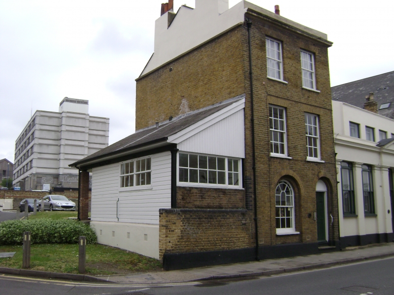
1.
5277 WEST STREET
(South Side)
No 44
TQ 6474 SE 1/197
II
2.
C18. 3 storeys brown brick. Parapet. 2 sashes with glazing bars intact. Round-headed
sash to ground floor and right side round-headed doorcase with 6 panelled door.
Cemented plinth. Later weatherboarded extension to left and 1 storey stuccoed
extension to right.
Listing NGR: TQ6450574426
External links are from the relevant listing authority and, where applicable, Wikidata. Wikidata IDs may be related buildings as well as this specific building. If you want to add or update a link, you will need to do so by editing the Wikidata entry.


Other nearby listed buildings
