Approximate Location Map
Large Map »
Latitude: 51.3484 / 51°20'54"N
Longitude: 0.7327 / 0°43'57"E
OS Eastings: 590400
OS Northings: 164581
OS Grid: TQ904645
Mapcode National: GBR RT6.D28
Mapcode Global: VHKJL.NC7N
Plus Code: 9F328PXM+93
Entry Name: Hinds House
Listing Date: 10 September 1951
Grade: II
Source: Historic England
Source ID: 1344218
English Heritage Legacy ID: 175752
ID on this website: 101344218
Location: Milton Regis, Swale, Kent, ME10
County: Kent
District: Swale
Electoral Ward/Division: Milton Regis
Parish: Non Civil Parish
Built-Up Area: Sittingbourne
Traditional County: Kent
Lieutenancy Area (Ceremonial County): Kent
Tagged with: House
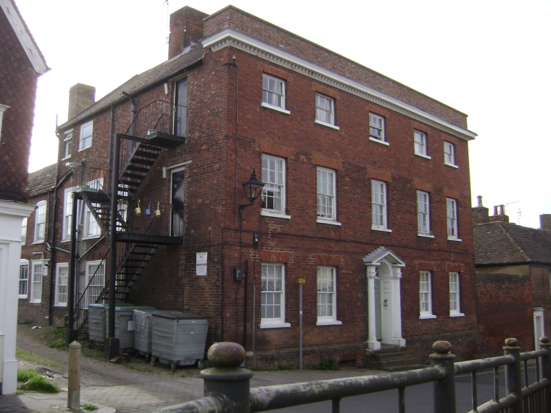
1.
5282 HIGH STREET
(East Side)
MILTON REGIS
No 60 (Hinds House) )
TO 9064 NW 1/72 10.9.51.
II GV
2.
A large Cl8 house. 3 storeys and basement red brick. Parapet. Wooden modillion
eaves cornice. 5 sashes with glazing bars intact. Doorcase up 4 steps with engaged
Ionic columns, pediment, semi-circular tympanum and door of 6 moulded and fielded
panels .
Nos 52 to 76 (even), 80 to 104 (even), 104A and ll0 form a group.
Listing NGR: TQ9040064581
External links are from the relevant listing authority and, where applicable, Wikidata. Wikidata IDs may be related buildings as well as this specific building. If you want to add or update a link, you will need to do so by editing the Wikidata entry.


Other nearby listed buildings
