Approximate Location Map
Large Map »
Latitude: 51.3418 / 51°20'30"N
Longitude: 0.7244 / 0°43'27"E
OS Eastings: 589847
OS Northings: 163830
OS Grid: TQ898638
Mapcode National: GBR QRV.XMK
Mapcode Global: VHKJL.HJTP
Plus Code: 9F328PRF+PQ
Entry Name: Westfield
Listing Date: 13 December 1974
Grade: II
Source: Historic England
Source ID: 1344245
English Heritage Legacy ID: 175799
ID on this website: 101344245
Location: Chalkwell, Swale, Kent, ME10
County: Kent
District: Swale
Electoral Ward/Division: Homewood
Parish: Non Civil Parish
Built-Up Area: Sittingbourne
Traditional County: Kent
Lieutenancy Area (Ceremonial County): Kent
Tagged with: Building
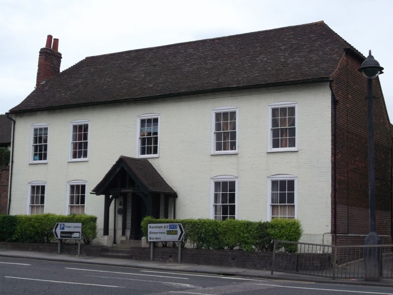
1.
5282 LONDON ROAD
(South Side)
MILTON REGIS
No 53 (Westfield)
TQ 86 SE 8/42
II
2.
C18. 2 storeys painted brick, Half-hipped tiled roof with sprocket eaves cornice.
5 sashes with cambered head linings having glazing bars intact. C19 gabled porch.
Doorcase in moulded architrave surround with door of 6 fielded panels. This probably
once had a pediment, now blocked by the porch.
Listing NGR: TQ8984763830
External links are from the relevant listing authority and, where applicable, Wikidata. Wikidata IDs may be related buildings as well as this specific building. If you want to add or update a link, you will need to do so by editing the Wikidata entry.


Other nearby listed buildings
