Approximate Location Map
Large Map »
Latitude: 52.1316 / 52°7'53"N
Longitude: -2.2142 / 2°12'51"W
OS Eastings: 385434
OS Northings: 248162
OS Grid: SO854481
Mapcode National: GBR 1GX.C0S
Mapcode Global: VH930.KPT9
Plus Code: 9C4V4QJP+J8
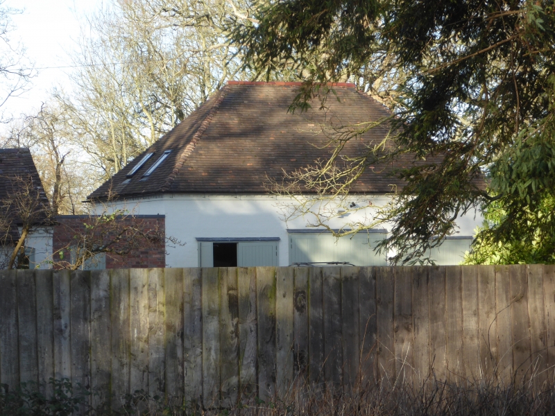
Entry Name: Draycott Coach House
Listing Date: 4 August 1977
Grade: II
Source: Historic England
Source ID: 1349242
English Heritage Legacy ID: 153344
ID on this website: 101349242
Location: Draycott, Malvern Hills, Worcestershire, WR5
County: Worcestershire
District: Malvern Hills
Civil Parish: Kempsey
Traditional County: Worcestershire
Lieutenancy Area (Ceremonial County): Worcestershire
Church of England Parish: The baptist
Church of England Diocese: Worcester
Tagged with: Carriage house
This list entry was subject to a Minor Amendment on 09/09/2020
SO 8448-8548
10/31
KEMPSEY CP
MAIN ROAD
Draycott Coach House
(Formerly listed as Coach House approximately 20 metres to east of Draycott Lodge, WORCESTER ROAD (east side))
4.8.77
GV
II
Coach house. Circa 1800. Painted brick with hipped tile roof. One storey with loft. West wall, facing house, has a lunette window to each side of the doorway. Above the doorway under the eaves is a small window lighting the loft. The doorway has a glazed round head. The south wall has a wide carriage doorway and a narrower doorway to the right, and a small pitching door under the eaves. Included for group value.
Listing NGR: SO8543448162
External links are from the relevant listing authority and, where applicable, Wikidata. Wikidata IDs may be related buildings as well as this specific building. If you want to add or update a link, you will need to do so by editing the Wikidata entry.


Other nearby listed buildings
