Approximate Location Map
Large Map »
Latitude: 51.3838 / 51°23'1"N
Longitude: 1.3847 / 1°23'5"E
OS Eastings: 635613
OS Northings: 170412
OS Grid: TR356704
Mapcode National: GBR WZZ.2XG
Mapcode Global: VHLG6.YHF0
Plus Code: 9F3399MM+GV
Entry Name: 17 and 19, Victoria Road
Listing Date: 22 February 1973
Grade: II
Source: Historic England
Source ID: 1350896
English Heritage Legacy ID: 356715
ID on this website: 101350896
Location: Margate, Thanet, Kent, CT9
County: Kent
District: Thanet
Electoral Ward/Division: Margate Central
Parish: Non Civil Parish
Built-Up Area: Margate
Traditional County: Kent
Lieutenancy Area (Ceremonial County): Kent
Tagged with: Building
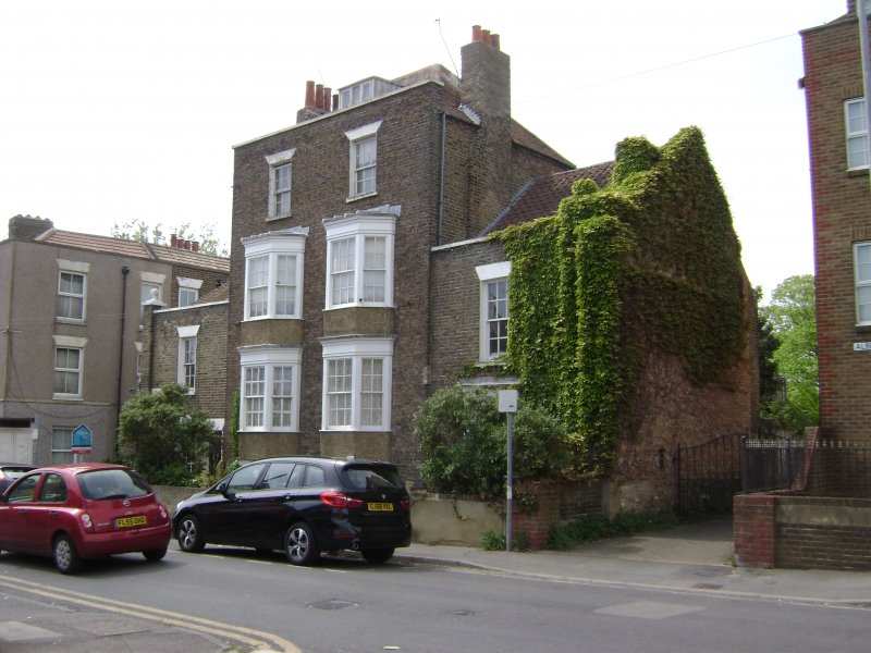
VICTORIA ROAD
1.
1380
(North West Side)
Nos 17 and 19
TR 3570 SE 5/338
II
2.
An early C19 pair. 3 storeys and basement brown brick. Each has a 2 storey
extension of 1 bay. Hipped tiled roof with 1 dormer. Stone coping. 1 sash
each with glazing bars intact. 2 3-light bays through ground and first floors.
The extensions have simple doorcases and parapets surmounted by ball finials.
Listing NGR: TR3561370412
External links are from the relevant listing authority and, where applicable, Wikidata. Wikidata IDs may be related buildings as well as this specific building. If you want to add or update a link, you will need to do so by editing the Wikidata entry.


Other nearby listed buildings
