Approximate Location Map
Large Map »
Latitude: 51.3906 / 51°23'25"N
Longitude: 1.3844 / 1°23'3"E
OS Eastings: 635557
OS Northings: 171160
OS Grid: TR355711
Mapcode National: GBR WZS.NV7
Mapcode Global: VHLG6.Y98V
Plus Code: 9F3399RM+6Q
Entry Name: 7, Trinity Square
Listing Date: 22 February 1973
Grade: II
Source: Historic England
Source ID: 1351051
English Heritage Legacy ID: 356691
ID on this website: 101351051
Location: Margate, Thanet, Kent, CT9
County: Kent
District: Thanet
Electoral Ward/Division: Margate Central
Parish: Non Civil Parish
Built-Up Area: Margate
Traditional County: Kent
Lieutenancy Area (Ceremonial County): Kent
Tagged with: Building
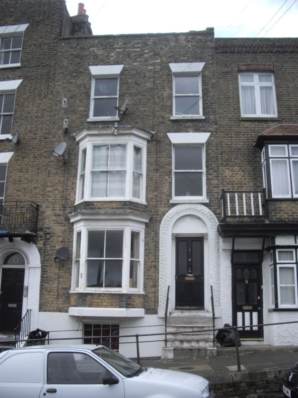
1. TRINITY SQUARE
1380
(West Side)
No 7
TR 3571 SE 3/313
II GV
2.
Early C19. 3 storeys and basement brown brick. Stone coping. 2 altered
sashes and 1 3-light bay through ground and 1st floor. Simple round-headed
doorcases with ornate plaster surround.
Nos 1 to 7 (consec), Nos 9 to 24 (consec) and railings outside Nos 1 to 7
form a group with Nos 1 & 2 Albion Place
Listing NGR: TR3555771160
External links are from the relevant listing authority and, where applicable, Wikidata. Wikidata IDs may be related buildings as well as this specific building. If you want to add or update a link, you will need to do so by editing the Wikidata entry.


Other nearby listed buildings
