Approximate Location Map
Large Map »
Latitude: 51.3857 / 51°23'8"N
Longitude: 1.3837 / 1°23'1"E
OS Eastings: 635531
OS Northings: 170614
OS Grid: TR355706
Mapcode National: GBR WZZ.2N3
Mapcode Global: VHLG6.XFWL
Plus Code: 9F3399PM+7F
Entry Name: 13, St John's Road
Listing Date: 22 February 1973
Grade: II
Source: Historic England
Source ID: 1351085
English Heritage Legacy ID: 356668
ID on this website: 101351085
Location: Margate, Thanet, Kent, CT9
County: Kent
District: Thanet
Electoral Ward/Division: Margate Central
Parish: Non Civil Parish
Built-Up Area: Margate
Traditional County: Kent
Lieutenancy Area (Ceremonial County): Kent
Tagged with: Building
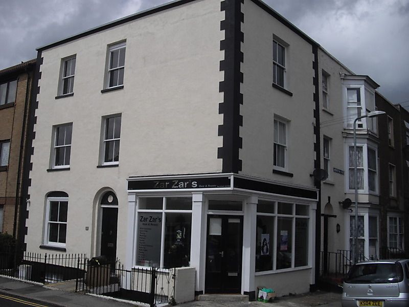
ST JOHN'S ROAD
1
1380
(North East Side)
No 13
TR 3570 NE 6/292
II GV
2.
Early C19. 3 storeys and basement cement-rendered. Coping and end quoins.
2 altered sashes. Ground floor has a simple round-headed doorcase and late
C19 shopfront. Cast iron spear railings.
No 13 forms a group with Nos 1 to 13 (odd) Addington Street
Listing NGR: TR3553170614
External links are from the relevant listing authority and, where applicable, Wikidata. Wikidata IDs may be related buildings as well as this specific building. If you want to add or update a link, you will need to do so by editing the Wikidata entry.


Other nearby listed buildings
