Approximate Location Map
Large Map »
Latitude: 50.8394 / 50°50'21"N
Longitude: -0.6612 / 0°39'40"W
OS Eastings: 494364
OS Northings: 105279
OS Grid: SU943052
Mapcode National: GBR FJ8.7NB
Mapcode Global: FRA 96HW.B77
Plus Code: 9C2XR8QQ+PG
Entry Name: The Old House
Listing Date: 20 September 1984
Grade: II
Source: Historic England
Source ID: 1353882
English Heritage Legacy ID: 297856
ID on this website: 101353882
Location: Westergate, Arun, West Sussex, PO20
County: West Sussex
District: Arun
Civil Parish: Eastergate
Built-Up Area: Westergate
Traditional County: Sussex
Lieutenancy Area (Ceremonial County): West Sussex
Church of England Parish: Aldingbourne, Barnham and Eastergate
Church of England Diocese: Chichester
Tagged with: House Thatched cottage
SU 90 NW EASTERGATE CHURCH LANE
7/421
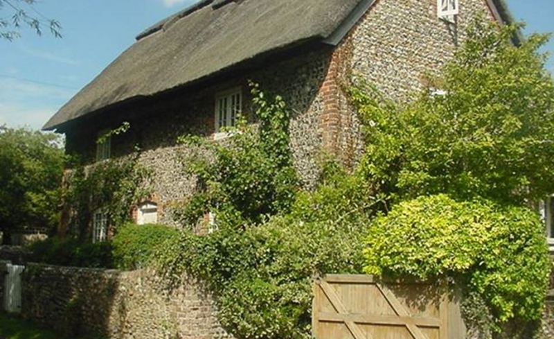
The Old House
II
C18. Two storeys. Two windows. Faced with squared knapped flints with red brick
dressings and quoins. Hipped thatched roof. Casement windows.
Listing NGR: SU9436205275
External links are from the relevant listing authority and, where applicable, Wikidata. Wikidata IDs may be related buildings as well as this specific building. If you want to add or update a link, you will need to do so by editing the Wikidata entry.


Other nearby listed buildings
