Approximate Location Map
Large Map »
Latitude: 51.613 / 51°36'46"N
Longitude: -1.7865 / 1°47'11"W
OS Eastings: 414878
OS Northings: 190484
OS Grid: SU148904
Mapcode National: GBR 4TN.Z08
Mapcode Global: VHB36.ZQDB
Plus Code: 9C3WJ677+59
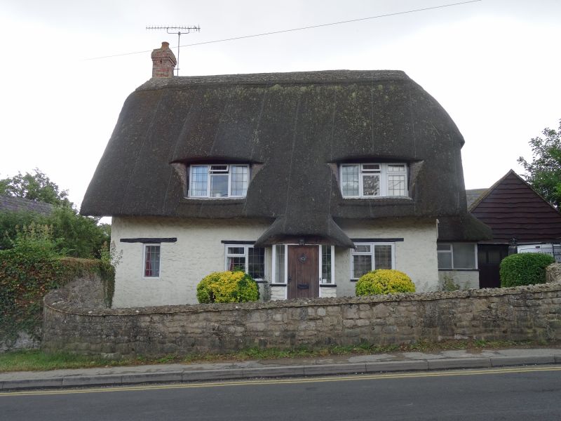
Entry Name: 47, High Street
Listing Date: 20 September 1979
Grade: II
Source: Historic England
Source ID: 1356001
English Heritage Legacy ID: 318239
ID on this website: 101356001
Location: Broad Blunsdon, Swindon, Wiltshire, SN26
County: Swindon
Civil Parish: Blunsdon St Andrew
Built-Up Area: Broad Blunsdon
Traditional County: Wiltshire
Lieutenancy Area (Ceremonial County): Wiltshire
Church of England Parish: Broad Blunsdon
Church of England Diocese: Bristol
Tagged with: Building Thatched cottage
1.
5410 BLUNSDON ST ANDREW HIGH STREET
(south side)
Broad Blunsdon
No 47
SU 1490 21/82
II
2.
C18/early C19 modernized and renovated. One and a half storey thatched cottage.
'L' plan. Brick chimney to left. Two dormers and 3 windows, modern leaded
casements. Projecting modern porch off centre right.
Listing NGR: SU1487890484
External links are from the relevant listing authority and, where applicable, Wikidata. Wikidata IDs may be related buildings as well as this specific building. If you want to add or update a link, you will need to do so by editing the Wikidata entry.


Other nearby listed buildings
