Approximate Location Map
Large Map »
Latitude: 51.3466 / 51°20'47"N
Longitude: -1.7984 / 1°47'54"W
OS Eastings: 414135
OS Northings: 160852
OS Grid: SU141608
Mapcode National: GBR 4XY.G53
Mapcode Global: VHB4K.SF32
Plus Code: 9C3W86W2+JJ
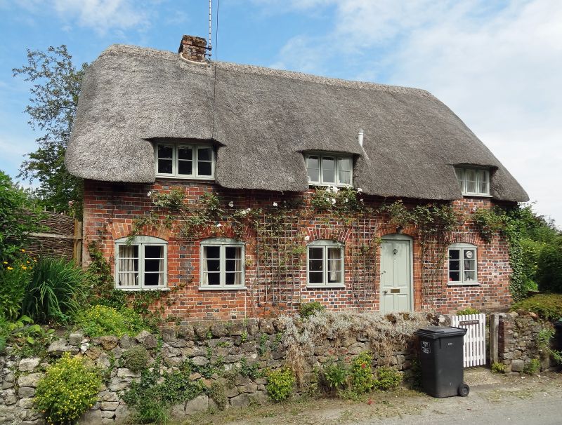
Entry Name: The Old Post Office
Listing Date: 30 October 1987
Grade: II
Source: Historic England
Source ID: 1364667
English Heritage Legacy ID: 311785
ID on this website: 101364667
Location: Wilcot, Wiltshire, SN9
County: Wiltshire
Civil Parish: Wilcot
Traditional County: Wiltshire
Lieutenancy Area (Ceremonial County): Wiltshire
Tagged with: Post office Thatched cottage
WILCOT CHURCH END
SU 16 SW (north-west side)
5/149 The Old Post Office
II
Cottage. Mid C18. Diaper brickwork with thatched roof. Single
storey and attic, 3 bays. Four-panelled door between bays 2 and 3.
C19 timber casement windows with segmental brick arches. Three
flush dormers to front, one to rear. Datestone over door reads M /
W L / 1746. Roof extended down at rear over narrow service rooms.
Listing NGR: SU1413560852
External links are from the relevant listing authority and, where applicable, Wikidata. Wikidata IDs may be related buildings as well as this specific building. If you want to add or update a link, you will need to do so by editing the Wikidata entry.


Other nearby listed buildings
