Approximate Location Map
Large Map »
Latitude: 51.7514 / 51°45'4"N
Longitude: -1.256 / 1°15'21"W
OS Eastings: 451452
OS Northings: 206115
OS Grid: SP514061
Mapcode National: GBR 8Z4.18J
Mapcode Global: VHCXV.57TQ
Plus Code: 9C3WQP2V+HH
Entry Name: Christchurch, Boundary Wall Fronting Blue Boar Street
Listing Date: 28 June 1972
Grade: II
Source: Historic England
Source ID: 1369652
English Heritage Legacy ID: 244887
ID on this website: 101369652
Location: Oxford, Oxfordshire, OX1
County: Oxfordshire
District: Oxford
Electoral Ward/Division: Holywell
Parish: Non Civil Parish
Built-Up Area: Oxford
Traditional County: Oxfordshire
Lieutenancy Area (Ceremonial County): Oxfordshire
Church of England Parish: Oxford St Michael and St Martin and All Saints
Church of England Diocese: Oxford
Tagged with: Architectural structure
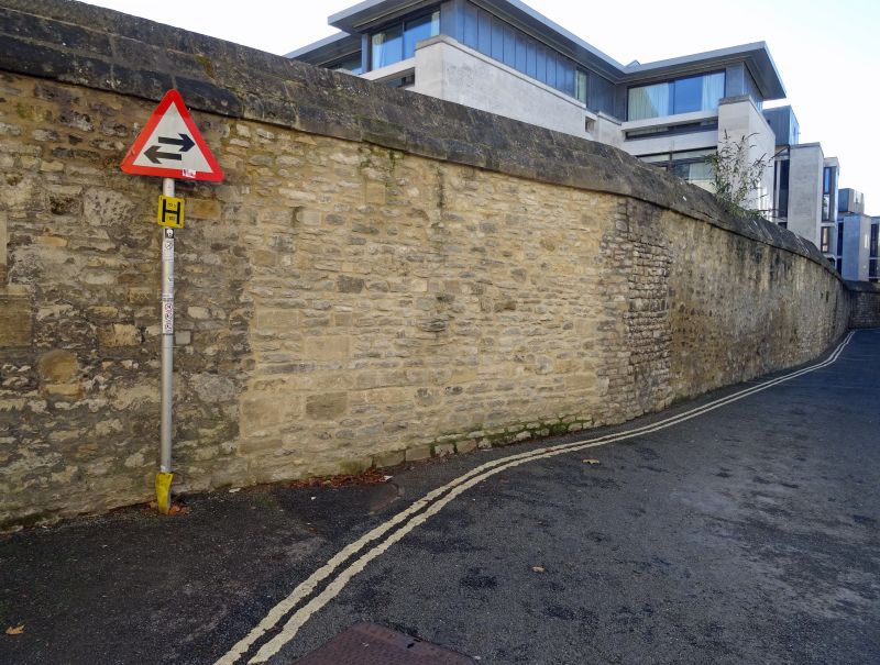
CHRISTCHURCH
1.
1485
Boundary wall fronting
Blue Boar Street
SP 5106 SW 8/453P
II
2.
C18 or earlier. Rubble wall.
Listing NGR: SP5145206115
External links are from the relevant listing authority and, where applicable, Wikidata. Wikidata IDs may be related buildings as well as this specific building. If you want to add or update a link, you will need to do so by editing the Wikidata entry.


Other nearby listed buildings
