Approximate Location Map
Large Map »
Latitude: 51.5711 / 51°34'15"N
Longitude: -0.1498 / 0°8'59"W
OS Eastings: 528319
OS Northings: 187426
OS Grid: TQ283874
Mapcode National: GBR DT.NX0
Mapcode Global: VHGQL.CR4Y
Plus Code: 9C3XHVC2+C3
Entry Name: Former District Police Station
Listing Date: 14 May 1974
Last Amended: 11 January 1999
Grade: II
Source: Historic England
Source ID: 1379046
English Heritage Legacy ID: 478412
ID on this website: 101379046
Location: Parliament Hill, Camden, London, N6
County: London
District: Camden
Electoral Ward/Division: Highgate
Parish: Non Civil Parish
Built-Up Area: Camden
Traditional County: Middlesex
Lieutenancy Area (Ceremonial County): Greater London
Church of England Parish: St Michael Highgate
Church of England Diocese: London
Tagged with: Building
This list entry was subject to a Minor Amendment on 9 June 2022 to update the name and address and to reformat the text to current standards
TQ2887SW
798-1/5/875
CAMDEN
HIGHGATE WEST HILL (East side)
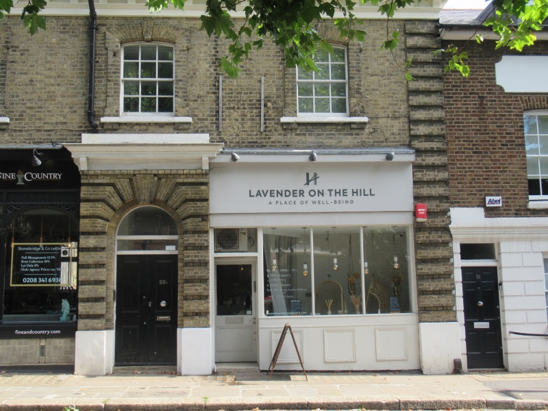
Nos.49 and 50
(Formerly Listed as: Nos.49, 50, 51 AND 51A , previously Listed as: HIGHGATE WEST HILL Nos.49, 50 AND 51A)
14/05/74
GV
II
Highgate District Police Station and Justice Room, now shops and offices. c1850. For the Metropolitan Police. Yellow stock brick with brick quoins. Two storeys and basements. Double fronted with three windows. Single storey one bay extension to left. Central projecting portico with rusticated brickwork, keystone, bracketed cornice and blocking course; round-arched doorway with fanlight and double panelled doors. Ground floor with C20 reproduction C19 wooden shopfronts. First floor with brick architraves and keystones to segmental-arched recessed sashes. Bracketed stucco cornice, brick blocking course.
INTERIOR: not inspected.
HISTORICAL NOTE: the building ceased functioning as a police station in 1902 when a new station was built in Archway Road.
(Survey of London: Vol. XVII, The Village of Highgate (Parish of St Pancras part I): London: -1936: 107-8).
Listing NGR: TQ2831687418
External links are from the relevant listing authority and, where applicable, Wikidata. Wikidata IDs may be related buildings as well as this specific building. If you want to add or update a link, you will need to do so by editing the Wikidata entry.


Other nearby listed buildings
