Approximate Location Map
Large Map »
Latitude: 53.4546 / 53°27'16"N
Longitude: -1.9441 / 1°56'38"W
OS Eastings: 403811
OS Northings: 395314
OS Grid: SK038953
Mapcode National: GBR GXVH.XC
Mapcode Global: WHB9T.3FJH
Plus Code: 9C5WF334+R9
Entry Name: Laneside Farm
Listing Date: 22 May 2000
Grade: II
Source: Historic England
Source ID: 1384308
English Heritage Legacy ID: 484742
ID on this website: 101384308
Location: Old Glossop, High Peak, Derbyshire, SK13
County: Derbyshire
District: High Peak
Electoral Ward/Division: Dinting
Parish: Non Civil Parish
Built-Up Area: Glossop
Traditional County: Derbyshire
Lieutenancy Area (Ceremonial County): Derbyshire
Church of England Parish: Glossop All Saints
Church of England Diocese: Derby
Tagged with: Farmhouse Model farm Agricultural structure
GLOSSOP
SK0395 WOODHEAD ROAD
921-1/9/26 (East side (off))
Laneside Farm
II
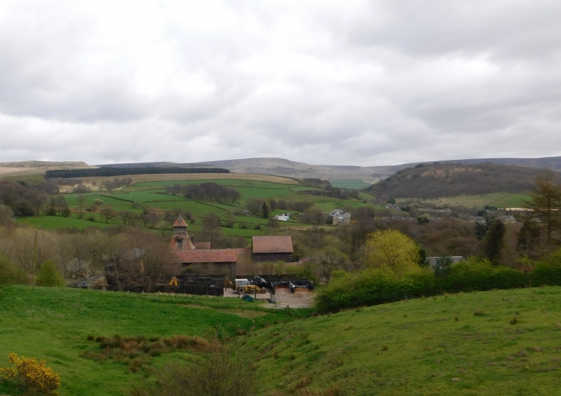
Model farmhouse and farm buildings. c1899 with C20
alterations. Built for Lord Howard. Blue brick with red brick
and ashlar dressings, plain tile roofs with overhanging eaves.
STYLE: Swiss.
EXTERIOR: 2 storey and single storey. Farm buildings ranged
around 3 sides of courtyard with the farmhouse and dairy
beyond to rear of east side. Prominent tower of 4 stages at
north east corner. Square plan with double tier, bell canted,
pyramidal roofs with weather vane finial, glazing bar windows
to ground floor, single loft doors to granary above and single
dormer to each face of lower roof, then wooden louvred
ventilator top stage.
Other extant buildings include large 2 storey shippon to east
side, south front has central glazing bar window flanked by
single cart entrances, above central round headed loft door
flanked by single glazing bar windows.
To west side of shippon, 2 walled pig styes, originally 5 and
west range includes open 4 bay single storey cart shed with
brick piers. Entrance to south has low curved walls and square
gate piers with ashlar pyramidal caps. To north of north range
remains horse gin.
The farmhouse, L-plan with porch in angle. The dairy was
originally intended to be thatched, and has hoodmoulds over
window openings, an open verandah survives.
The Smithy has been demolished.
INTERIOR: not inspected, access denied.
Listing NGR: SK0381195314
External links are from the relevant listing authority and, where applicable, Wikidata. Wikidata IDs may be related buildings as well as this specific building. If you want to add or update a link, you will need to do so by editing the Wikidata entry.


Other nearby listed buildings
