Approximate Location Map
Large Map »
Latitude: 51.2366 / 51°14'11"N
Longitude: -0.3189 / 0°19'8"W
OS Eastings: 517455
OS Northings: 149942
OS Grid: TQ174499
Mapcode National: GBR HGJ.J5L
Mapcode Global: VHGS7.F58W
Plus Code: 9C3X6MPJ+JC
Entry Name: Dorking Cemetery Lodge, Entrance Arch, Former Mortuary and Attached Walls
Listing Date: 23 June 1999
Grade: II
Source: Historic England
Source ID: 1387308
English Heritage Legacy ID: 475258
ID on this website: 101387308
Location: Pixham, Mole Valley, Surrey, RH4
County: Surrey
District: Mole Valley
Electoral Ward/Division: Dorking South
Parish: Non Civil Parish
Built-Up Area: Dorking
Traditional County: Surrey
Lieutenancy Area (Ceremonial County): Surrey
Church of England Parish: Dorking St Martin
Church of England Diocese: Guildford
Tagged with: Architectural structure
TQ14NE DORKING REIGATE ROAD
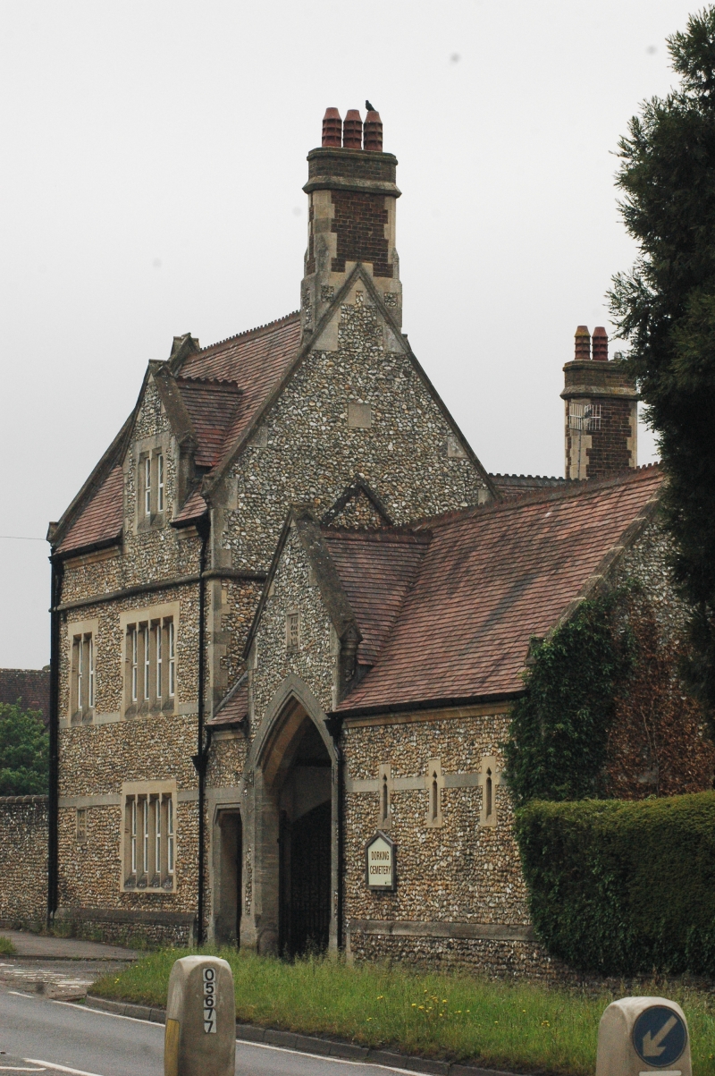
850/10/10020 Dorking Cemetery Lodge,
entrance arch, former
mortuary and walls
GV II
Cemetery lodge with attached entrance arch, mortuary chapel and walls. Built in 1856 by the firm of Cubitt and sons to the design of Henry Clutton. Early English style. Built of flint with stone dressings and tiled roof with ridge tiles and two stone chimneystacks. Lodge to extreme left of two storeys and attics; 2:1 windows to front. Windows have Caernarvon arches and have late C20 UPVC replacement windows. L-shaped plan. Front has one two-light casement and one four-light casement to first floor. Gabled dormer. Plinth and bands between floors. Rear has lower gabled wing of two bays with external chimneystack. Adjoining is an entrance archway and former mortuary of one storey. To the left is a Caernarvon-arched pedestrian arch, an arched carriage entrance under gable with kneelers. Three lancets, a triple arched window and a further lancet to front elevation. Rear has timber-framed verandah and gable. Attached is a low flint cemetery wall with brick buttresses, stone coping, brick and stone gatepiers and cast iron gates with quatrefoil motifs.
Listing NGR: TQ1745549942
External links are from the relevant listing authority and, where applicable, Wikidata. Wikidata IDs may be related buildings as well as this specific building. If you want to add or update a link, you will need to do so by editing the Wikidata entry.


Other nearby listed buildings
