Approximate Location Map
Large Map »
Latitude: 51.0644 / 51°3'51"N
Longitude: -1.316 / 1°18'57"W
OS Eastings: 448024
OS Northings: 129675
OS Grid: SU480296
Mapcode National: GBR 861.B26
Mapcode Global: FRA 8649.M3P
Plus Code: 9C3W3M7M+QH
Entry Name: 16, Jewry Street
Listing Date: 14 January 1974
Grade: II
Source: Historic England
Source ID: 1387462
English Heritage Legacy ID: 475426
ID on this website: 101387462
Location: Hyde, Winchester, Hampshire, SO23
County: Hampshire
District: Winchester
Electoral Ward/Division: St Michael
Parish: Non Civil Parish
Built-Up Area: Winchester
Traditional County: Hampshire
Lieutenancy Area (Ceremonial County): Hampshire
Church of England Parish: Winchester Holy Trinity
Church of England Diocese: Winchester
Tagged with: Building
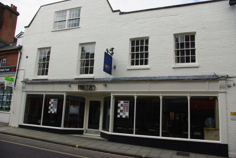
JEWRY STREET
1.
1833
(West Side)
No 16
SU 4829 NW 3/379
II
2.
C18, with a C19 shop front. Rendered. Two and three storeys, four windows
on the first floor. sashes with glazing bars. one tripartite sash above.
Gable, old tile roof behind parapet. Graded for group value.
Listing NGR: SU4802429675
External links are from the relevant listing authority and, where applicable, Wikidata. Wikidata IDs may be related buildings as well as this specific building. If you want to add or update a link, you will need to do so by editing the Wikidata entry.


Other nearby listed buildings
