Approximate Location Map
Large Map »
Latitude: 52.1903 / 52°11'25"N
Longitude: -2.219 / 2°13'8"W
OS Eastings: 385125
OS Northings: 254693
OS Grid: SO851546
Mapcode National: GBR 1G4.PSJ
Mapcode Global: VH92T.H68R
Plus Code: 9C4V5QRJ+4C
Entry Name: 24, Friar Street
Listing Date: 5 April 1971
Grade: II
Source: Historic England
Source ID: 1389844
English Heritage Legacy ID: 488795
ID on this website: 101389844
Location: Worcester, Worcestershire, WR1
County: Worcestershire
District: Worcester
Electoral Ward/Division: Cathedral
Parish: Non Civil Parish
Built-Up Area: Worcester
Traditional County: Worcestershire
Lieutenancy Area (Ceremonial County): Worcestershire
Church of England Parish: Worcester St Nicholas and All Saints
Church of England Diocese: Worcester
Tagged with: Building
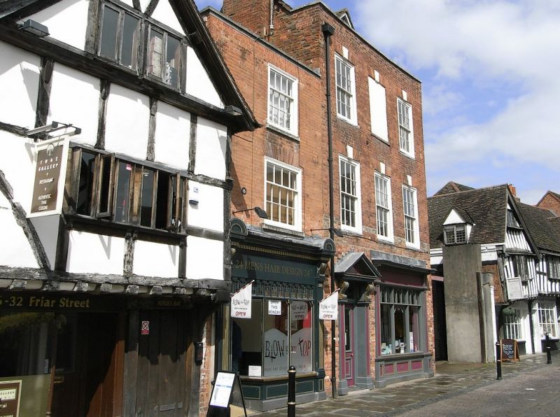
WORCESTER
SO8554NW FRIAR STREET
620-1/17/288 (West side)
05/04/71 No.24
GV II
House, now shop. Probably early C18 with later additions and
alterations including restorations and shop front c1990, on
the site of an earlier building. Reddish-orange brick in
Flemish bond with gauged red brick arches and ashlar copings
and sills; concealed roof, tall brick right end stack, partly
rebuilt, with oversailing course and pots. 3 storeys, 1
first-floor window. First and second floors each have one 4/8
flush sash under flat arch of gauged brick and renewed sills.
Low coped parapet. Ground floor has Victorian style glazed
shop front with part-glazed door.
INTERIOR: not inspected.
HISTORICAL NOTE:
Friar Street originated as a rear access lane for buildings in
the High Street until the foundation of the Franciscan Friary
in 1235. The first Friary buildings occupied the stretch
between Nos 11-25. The south end of the street was developed
first, with plots dating from the mid C14, plots at the north
end date frm the early C15. Many of the existing houses date
from the Reformation, the Friary having been suppressed in
1539 and its property sold by the Crown to the Corporation of
Worcester which demolished much for building materials.
Building continued from c1540 onwards, modifications were made
to houses during the C17 whilst several older houses were
rebuilt in the C18. The street was inhabited mainly by
tradesmen: weavers, clothiers, brewers and innkeepers. City of
Worcester Award for restoration, 1993.
(Hughes P and Molyneux N: Friar Street: 1984-: 31).
External links are from the relevant listing authority and, where applicable, Wikidata. Wikidata IDs may be related buildings as well as this specific building. If you want to add or update a link, you will need to do so by editing the Wikidata entry.


Other nearby listed buildings
