Approximate Location Map
Large Map »
Latitude: 51.3773 / 51°22'38"N
Longitude: -2.3631 / 2°21'47"W
OS Eastings: 374821
OS Northings: 164316
OS Grid: ST748643
Mapcode National: GBR 0QH.PC0
Mapcode Global: VH96M.0N10
Plus Code: 9C3V9JGP+WP
Entry Name: 16, 18 and 20, Wells Road
Listing Date: 5 August 1975
Last Amended: 15 October 2010
Grade: II
Source: Historic England
Source ID: 1395607
English Heritage Legacy ID: 511017
ID on this website: 101395607
Location: Beechen Cliff, Bath and North East Somerset, Somerset, BA2
County: Bath and North East Somerset
Parish: Non Civil Parish
Built-Up Area: Bath
Traditional County: Somerset
Lieutenancy Area (Ceremonial County): Somerset
Tagged with: Building
WELLS ROAD
656-1/40/1820 (North side)
Nos.16, 18 AND 20
(Formerly Listed as:
WELLS ROAD Nos.12-32 (Even))
05/08/75
GV II
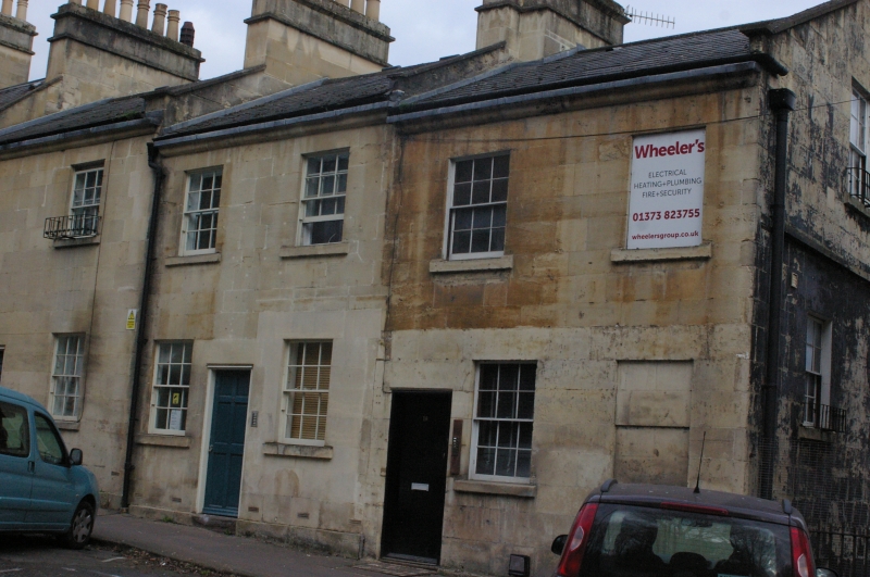
Three houses in stepped row. c1820.
MATERIALS: Limestone ashlar, slate roofs.
PLAN: Double depth plan but under wide span gabled roof.
EXTERIOR: Two storeys, and two lower ground floors created by drop in site from street front, each two windows, all sashes. No.16 has plain and blind light to each level, that at first floor with painted sixteen-pane, and flush six-panel door, return to right has coped gable above large ashlar block, with square string course above upper floor, and single plain sash at four levels, with offset rubble plinth to lowest floor. No.18 has good twelve-pane replacements, and, near central, five-panel fielded door, top panel glazed. No.20 similar, but with balconettes to upper windows. Each house has small plinth dying to pavement to left, heavy stone cyma eaves cornice, coped party divisions with kneelers, and ashlar stacks, combined in Nos.16 and 18. Rear immediately adjacent to railway line, and not accessible.
INTERIORS: Not inspected.
Part of a stepped row in Wells Road (qqv). Included for group value. The Road to Wells and Exeter was described as 'The New Road' on Chantry's 1793 plan of Bath.
Listing NGR: ST7482164316
External links are from the relevant listing authority and, where applicable, Wikidata. Wikidata IDs may be related buildings as well as this specific building. If you want to add or update a link, you will need to do so by editing the Wikidata entry.


Other nearby listed buildings
