Approximate Location Map
Large Map »
Latitude: 52.2054 / 52°12'19"N
Longitude: 0.1191 / 0°7'8"E
OS Eastings: 544902
OS Northings: 258467
OS Grid: TL449584
Mapcode National: GBR L79.LY6
Mapcode Global: VHHK3.0TTQ
Plus Code: 9F426449+5J
Entry Name: Market Place paving and two sets of iron railings
Listing Date: 30 October 2019
Grade: II
Source: Historic England
Source ID: 1467164
ID on this website: 101467164
Granite setts laid out in 1855-1856 and iron railings installed later in the C19.
Granite setts laid out in 1855-1856 and iron railings installed later in the C19.
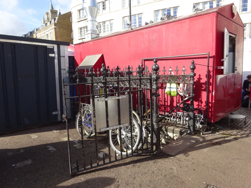
PLAN: the Market Place is approximately rectangular on plan and covers an area around 2000m². Within the north-western quarter of the Market Place are two sets of decorative iron railings which enclose the steps down to underground lavatories. Neither the steps nor the lavatories are included in the listing.
EXTERIOR: the Market Place is paved in granite setts. Two areas along the western side, totalling approximately 220m², have either been replaced or covered by asphalt; one area being laid to provide the hardstanding for a large rubbish compactor. The Grade II listed granite base of a mid-C19 fountain stands at the centre.
The iron railings have plain verticals with fleur-de-lys finials and a frieze of quatrefoils. The posts at the corners and mid-way along have square bases, circular shafts and shaped finials. The gate on the north railings is original but that on the south railings is a C20 replacement.
Following a major fire in 1849 the Cambridge Corporation Act enabled the expansion and laying out of the Market Place in its present form. This involved surfacing the area in granite setts between 1855 and 1856. Granite had been introduced as a street surface in the C18, initially in the form of cobbles and then squared setts brought mainly from Devon and Cornwall. It was hard to work but was extremely durable, and it became much more widespread from the 1830s when steam power, and later railways, facilitated its working and distribution.
As part of the works to the Market Place, the original Hobson’s Conduit Head was moved and a new Gothic fountain (Grade II) was built, although the upper part of the fountain weathered so badly that it had to be demolished in 1953. Underground lavatories and their enclosing railings were installed in the Market Place at some point later in the C19.
The granite setts laid out in 1855-1856 and iron railings installed later in the C19 are listed at Grade II for the following principal reasons:
Architectural interest:
* the setts are an integral part of the mid-C19 scheme for the expansion and re-laying of the Market Place and can be accurately dated to 1855-1856;
* given that the use of granite setts only became widespread from the 1830s, this is a relatively early surviving example of a large area of historic paving;
* the handsomely designed railings are of good quality ironwork and, other than one gate, are in their original condition.
Historic interest:
* as good quality examples of C19 street furniture, they make an important contribution to the historic streetscene;
* along with the Grade II listed fountain in the centre of the Market Place, they form a significant ensemble of historic street furniture in the commercial and civic heart of the city.
Group value:
* they have strong group value with the listed fountain and with a large number of listed buildings surrounding the Market Place, notably the Grade I listed Church of St Mary the Great on the west side and the Grade II listed Guildhall on the south side.
External links are from the relevant listing authority and, where applicable, Wikidata. Wikidata IDs may be related buildings as well as this specific building. If you want to add or update a link, you will need to do so by editing the Wikidata entry.


Other nearby listed buildings