Approximate Location Map
Large Map »
Latitude: 58.5657 / 58°33'56"N
Longitude: -4.7338 / 4°44'1"W
OS Eastings: 241085
OS Northings: 967418
OS Grid: NC410674
Mapcode National: GBR G6P2.VT0
Mapcode Global: WH26K.8Y2V
Plus Code: 9CCQH788+7F
Entry Name: Leirinbeg House, Durness
Listing Name: Leirinbeg House and Steading
Listing Date: 7 March 1984
Category: B
Source: Historic Scotland
Source ID: 330792
Historic Scotland Designation Reference: LB494
Building Class: Cultural
ID on this website: 200330792
Location: Durness
County: Highland
Electoral Ward: North, West and Central Sutherland
Parish: Durness
Traditional County: Sutherland
Tagged with: House
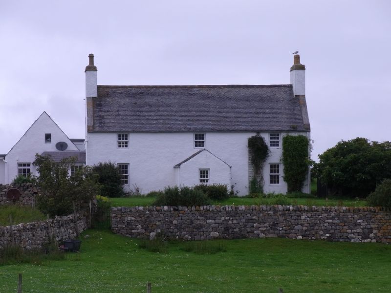
Dated 1810. 2-storey, 3-bay east facing house with centre
door masked by later projecting gabled porch. All harled.
Small 1st floor windows close to wallhead; 12-pane glazing;
corniced end stacks; slate roof.
Small rubble steading at right angles to house at SW corner,
but separate; slate roof.
Fine drystone coped walls surround house and garden.
Datestone with Sutherland arms in apex of south gable.
External links are from the relevant listing authority and, where applicable, Wikidata. Wikidata IDs may be related buildings as well as this specific building. If you want to add or update a link, you will need to do so by editing the Wikidata entry.


Other nearby listed buildings
