Approximate Location Map
Large Map »
Latitude: 57.4943 / 57°29'39"N
Longitude: -3.7374 / 3°44'14"W
OS Eastings: 295961
OS Northings: 846227
OS Grid: NH959462
Mapcode National: GBR K84X.GQD
Mapcode Global: WH5HN.KWHP
Plus Code: 9C9RF7V7+P2
Entry Name: Logie Bridge
Listing Name: Logie Bridge, Ferness (Over River Findhorn)
Listing Date: 26 January 1971
Category: A
Source: Historic Scotland
Source ID: 330897
Historic Scotland Designation Reference: LB564
Building Class: Cultural
ID on this website: 200330897
Location: Ardclach
County: Highland
Electoral Ward: Nairn and Cawdor
Parish: Ardclach
Traditional County: Nairnshire
Tagged with: Road bridge
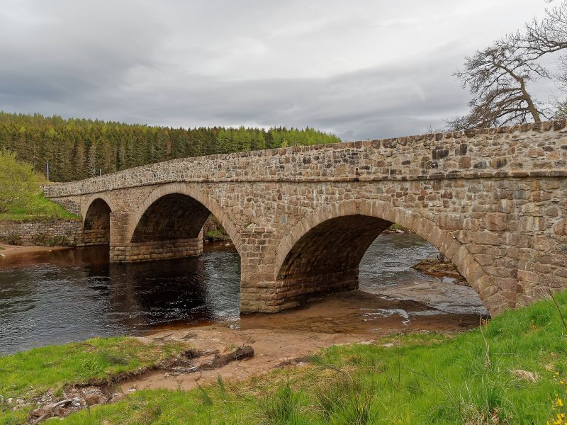
Thomas Telford, 1814-17; 3-span granite rubble bridge; 3 shallow segmental arch rings, the centre slightly larger than the outer
arches, all dressed granite. Dressed and rusticated triangular cutwaters; string course and parapet; slightly splayed
approaches. 150' span (approx.)
External links are from the relevant listing authority and, where applicable, Wikidata. Wikidata IDs may be related buildings as well as this specific building. If you want to add or update a link, you will need to do so by editing the Wikidata entry.


Other nearby listed buildings
