Approximate Location Map
Large Map »
Latitude: 55.824 / 55°49'26"N
Longitude: -3.0903 / 3°5'25"W
OS Eastings: 331788
OS Northings: 659509
OS Grid: NT317595
Mapcode National: GBR 61V3.R3
Mapcode Global: WH6T7.HWN4
Plus Code: 9C7RRWF5+HV
Entry Name: Bridge, Carrington Mill
Listing Name: Carrington Mill, Bridge to West over Redside Burn
Listing Date: 29 March 1999
Category: C
Source: Historic Scotland
Source ID: 331076
Historic Scotland Designation Reference: LB688
Building Class: Cultural
ID on this website: 200331076
Location: Carrington
County: Midlothian
Electoral Ward: Midlothian South
Parish: Carrington
Traditional County: Midlothian
Tagged with: Bridge
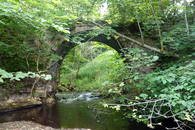
Early 19th century. Single span, round-arched bridge over Redside Burn. Tooled coursed sandstone with polished arch-ring. Slightly splayed wing walls. Parapets missing.
External links are from the relevant listing authority and, where applicable, Wikidata. Wikidata IDs may be related buildings as well as this specific building. If you want to add or update a link, you will need to do so by editing the Wikidata entry.


Other nearby listed buildings
