Approximate Location Map
Large Map »
Latitude: 55.769 / 55°46'8"N
Longitude: -4.282 / 4°16'55"W
OS Eastings: 256936
OS Northings: 655205
OS Grid: NS569552
Mapcode National: GBR 3Q.9KPW
Mapcode Global: WH3PN.6868
Plus Code: 9C7QQP99+H6
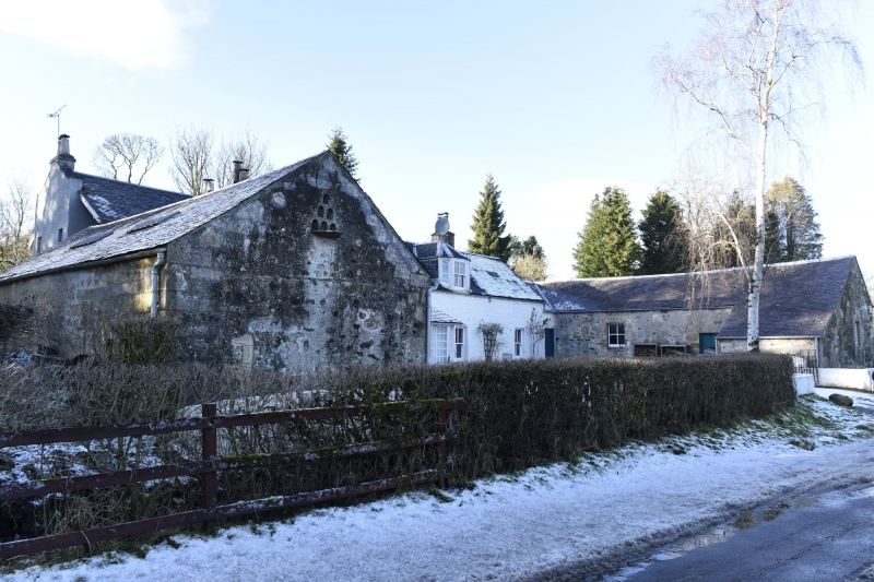
Entry Name: Dripps Mill House
Listing Name: Dripps Mill House
Listing Date: 20 February 1979
Category: C
Source: Historic Scotland
Source ID: 331473
Historic Scotland Designation Reference: LB1012
Building Class: Cultural
ID on this website: 200331473
Location: East Kilbride
County: South Lanarkshire
Electoral Ward: East Kilbride West
Parish: East Kilbride
Traditional County: Lanarkshire
Tagged with: House
Courtyard type farmhouse, restored and enlarged. 1938 addition. Offices dated 1759.
External links are from the relevant listing authority and, where applicable, Wikidata. Wikidata IDs may be related buildings as well as this specific building. If you want to add or update a link, you will need to do so by editing the Wikidata entry.


Other nearby listed buildings
