Approximate Location Map
Large Map »
Latitude: 55.7695 / 55°46'10"N
Longitude: -4.2817 / 4°16'54"W
OS Eastings: 256954
OS Northings: 655268
OS Grid: NS569552
Mapcode National: GBR 3Q.9KRW
Mapcode Global: WH3PN.67BV
Plus Code: 9C7QQP99+R8
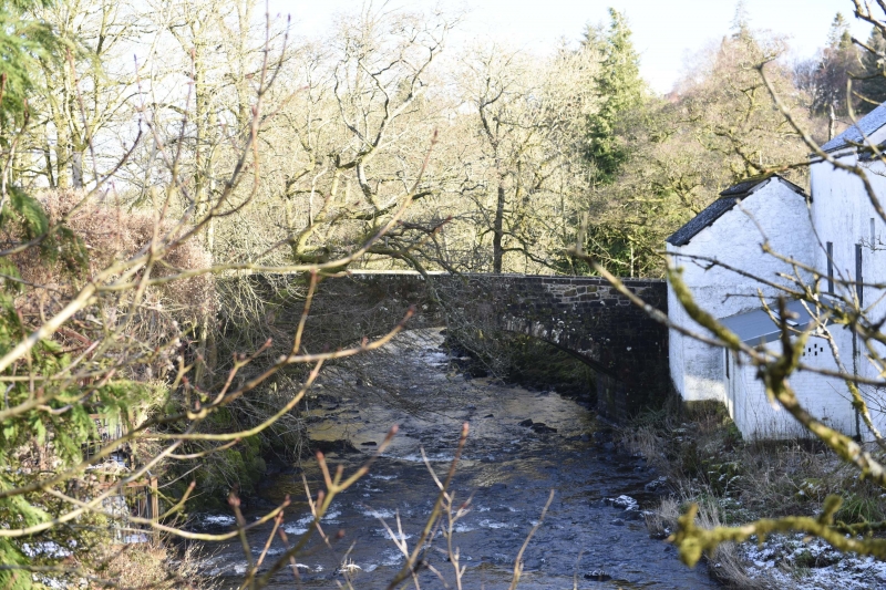
Entry Name: Waterfoot Bridge, Waterfoot Row, Waterfoot
Listing Name: Waterfoot Bridge
Listing Date: 15 March 1963
Category: B
Source: Historic Scotland
Source ID: 331475
Historic Scotland Designation Reference: LB1014
Building Class: Cultural
Also known as: Waterfoot, Waterfoot Row, Waterfoot Bridge
ID on this website: 200331475
Location: East Kilbride
County: South Lanarkshire
Electoral Ward: Newton Mearns South and Eaglesham
Parish: East Kilbride
Traditional County: Lanarkshire
Tagged with: Bridge
Spanning White Cart Water. Single arch with narrowing
parapet.
External links are from the relevant listing authority and, where applicable, Wikidata. Wikidata IDs may be related buildings as well as this specific building. If you want to add or update a link, you will need to do so by editing the Wikidata entry.


Other nearby listed buildings
