Approximate Location Map
Large Map »
Latitude: 55.4416 / 55°26'29"N
Longitude: -4.4969 / 4°29'48"W
OS Eastings: 242145
OS Northings: 619244
OS Grid: NS421192
Mapcode National: GBR 3G.ZBSD
Mapcode Global: WH3R2.WHS8
Plus Code: 9C7QCGR3+J6
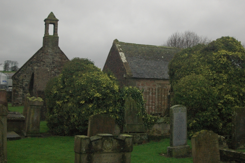
Entry Name: Old Parish Church And Graveyard, Low Coylton
Listing Name: Fragments of Previous Kirk in Old Graveyard.
Listing Date: 14 April 1971
Category: B
Source: Historic Scotland
Source ID: 331540
Historic Scotland Designation Reference: LB1065
Building Class: Cultural
ID on this website: 200331540
Location: Coylton
County: South Ayrshire
Electoral Ward: Maybole, North Carrick and Coylton
Parish: Coylton
Traditional County: Ayrshire
Tagged with: Church building Cemetery
Gable with belfry; vault, interesting monuments. 1830 Mears
bell and disused 1647 Monteith one.
External links are from the relevant listing authority and, where applicable, Wikidata. Wikidata IDs may be related buildings as well as this specific building. If you want to add or update a link, you will need to do so by editing the Wikidata entry.


Other nearby listed buildings
